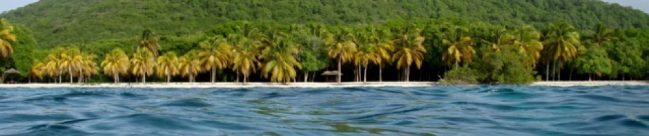
Off towards Loretto Pt 1, Ensenada La Raz, Isla San Fransisco, Bahía Amortajada


PHOTOS—>>. https://photos.app.goo.gl/BTAY6aLxa7JEPXhp7

Heading to Loretta pt1

After getting back from San Diego we jumped right back into boat chores. John had the dinghy up on the bow and tackled the leaks using the glue he purchased while we were away.

I got onto a deep clean from bow to stern. We both went on major restocking grocery trips, anticipating several weeks away from any supplies. Meanwhile the port was closed due to high winds. Once the port opened we were more or less ready, so after saying good bye to fellow dockside friends we headed out. 

The shallow channel leading out was still quite choppy, but we made good time as the tide was ebbing and this made travel quicker. Our destination was:

Ensenada De La Raz, Espiritu Santo

This bay is the northern most of three finger coves and offered better shelter. When we arrived we found the second bay had a few boats anchored but La Raz was unoccupied which was wonderful. We anchored in the shelter of some dramatic palisade cliffs with the bay’s shallow water stretching inward quite a ways. 

The next morning we headed ashore towards the long rocky spit. Having learned what happens in these parts with the dropping tide we anchored the dinghy off of the shoreline in a couple of feet of water and then waited ashore.

The rocky shoreline turned out to be a long peninsular which enclosed a salt pond. I really enjoyed walking along its length looking at what had been washed ashore.

There was all kinds of fish, many many shells, drift wood of all types.

Next we headed inland towards look for the supposed pathway which was to lead us to the other side of Espiritu Santo.

It was fine to begin with but, as we waked along the shoreline and at the mangroves we walked along the wetland, but then the pathway faded into the brush.

After just a short stretch of trying to walk this pathway my lower legs were all torn up from thorns.

Every single type of shrub, bush, and grass type vegetation has thorns! Thorns of all sizes and types and the only way we had to remove them was with our hands. We now carry pliers with us! See John’s burrs or thorns, and they didn’t come out easily.

Back we went, giving up finding the supposed pathway there. John saying it must be on the other side of the bay.

On the bright side the scenery was wonderful! And the exercise was needed.

Back at the dinghy we found that, yes, the tide had dropped, but we could just get over the shallows using the engine, so our timing was right. 

The following day, John was all set on finding the trail to the other side by scouting the other side of the bay. However the other side was much shallower, and had mangroves at the end.

So we had to leave the dinghy quite a ways down the shoreline anchored off of some rocks, walk the shallows and then the rocky shoreline.

What we found at the end was basically a dead end. However again it was a fun walk. On the way back John discovered an area,

where there must have been shelters built at one time as there were foundations there. Plus there were piles and piles of oyster shells,so maybe it was a fishing camp. 

Leaving Espiritu Santo for:

Isla San Francisco. 

“This is a pristine island known for its crescent-shaped bay, white sand beaches, and turquoise waters. Located roughly 75 km north of La Paz, it is a popular, remote destination for anchoring boats, kayaking, and hiking to panoramic viewpoints.”

The island is roughly 2.5 km by 2.5 km, with a distinctive, hooked, white-sand bay called Bahía Amortajada, or as most cruisers know it “the Hook” due to its hook like shape. It is in this bay we intended to anchor for a few days.

We were both excited to head to new territory and after reading about San Francisco we had high expectations.

Upon arrival we did anchor in the shelter of the hook, but came to regret our choice as this was also where all the charter cats anchored later in the day. So after a day surrounded by them we moved to the other end of the bay where mostly monohulls were anchored.

Exploring the agate beach

According to our information, on the other side of the island from us was a bay famous for agate.

What is agate?

Agate is a colorful, quite sort after, rock that typically develops within the cavities of volcanic and metamorphic rocks. These areas with layers of silica-rich fluids gradually formed leaving deposits and creating the stone’s distinct colour, banding and patterns.

Agate is also believed to have healing powers, and to enhance mental clarity, improve concentration, and more. So off we went basically agate hunting.

Up over the sand dunes, the views were captivating. Along pathways lined with thorny brush and cactus and then crossing the salt pond we went.

On the salt flats, there were pits dug for the salt to form and harvest, but due to the rain that had fallen just a few days before the pits were diluted.

Across the salt plain we trekked arriving at the agate beach. There were millions of rocks,no way of telling what was agate.

Down the beach we went me beach combing, John rock hunting.

The cliffs at the other end were very attractive with such unique formations and colours.

We did pick up several rocks, choosing the greens this time. But they weren’t agate according to John’s rock identifier.

I found many interesting odds and ends while beach combing. Several porcupine fish skeletons, loads of oyster shells, fossils and more. 

The cliffs and rocks were of amazing colors. Green, reds, yellows all types of rocks, it was a rough rocky beach walk.

Back to Aeeshah we headed after another very nice trek

Climbing the ridge

Above us was a ridge line where I spied several folks climbing, so that climb became our goal. The next morning off we set to hike the ridge.

Getting there we found a pathway halfway down the beach that cut over the dunes to the salt pond area. Next we crossed the shrub land on a trail that lead to a rocky pathway heading towards the ridge.

Up we went coming to the ridge line.

All the time the scenery was lovely, but from the ridge line the views proved to be amazing. We walked the narrow ridge, with rocky slopes on both sides of us me stopping to take photos.

At times the pathway was really quite treacherous, one slip and down you would go off the cliff on one side or down the steep slopes on the other.

Upon reaching the top we were both stunned by the view! It was stunning! And with the clear sky the colours were incredibly rich.

After spending a while on the top we headed down. The downward I found was much harder, mainly because of my recent knee surgery. Anyway I hung onto the back of the back pack on John’s back in case I slipped.

Halfway down we chose a different route by following the ridge along further to another lower view point.

We saw an osprey pair nesting on a ledge above the ocean. Way off in the distance we saw orcas swimming.

The hike was wonderful!

And then we were off again…..

“After climbing a great hill, one only finds that there are many more hills to climb ” – Nelson Mandela

“Realize deeply that the present moment is all you ever have” Eckhart Tolle

Posted in Weather | Leave a comment

Off to San Diego, 3 day visa run


Off to San Diego 

PHOTOS : https://photos.app.goo.gl/RH2DzgX6pSAcUNf66

Our choice of travel was to take a Voloris airline flight to Tuajuana and then to walk across the border using the Cross Border Xpress and enter the USA. To cab it to a hotel in the south of San Diego. 

The La Paz airport is a smaller airport, but very nice. We only had carry on each but ended up checking one bag of those free. The Volaris plane was new and comfortable, it was a full flight which lasted all of 1 hour. 

After arriving Tuajuana airport our first challenge came as we were checking into the Cross Border Xpress. This is where you submit your electronic ticket and then walk across to the USA. We were stopped because the machines did not recognize our Bermuda passport. Sooo, we were directed to go to the officials’ booth where we were questioned. They had absolutely no idea how to deal with a Bermuda passport so then had to call superiors for them to research Bermuda and entry into the USA. 

We were seated next to a lady who was, quite frankly, out of her mind with worry. She was in a terrible state. We tried calming her until finally she received her entrance permit. 

I guess we waited nearly an hour, finally we were permitted to walk the “bridge” to our destination. 

At the other end we were of course, again stopped by the American immigration folks who had no idea about Bermuda and travel agreements between Bermuda and the USA. They then handed us over to their superiors, who again had to check our Bermuda passports.

In this area we were not permitted to do anything but sit, in fact the woman was quite rude, she obviously distrusted everyone by the ugly, looks we received.

 Finally, after another half hour, we passed all the “tests” and we were granted our 3 days, but no more. 

Our hotel was perfect, just what we wanted, nearby, within walking distance of shops and restaurants. Plus the streets were walkable with sidewalks.

On our 1st day we went off and did the shopping we wanted to do. Basically stocking up on black tea bags which are an essential item for us both….gotta have cups of tea. And for me getting a new iPad, which makes my writing while underway possible. Shopping was easy and quick.

Imperial Beach pier

Imperial Beach pier, the southern most pier in the United States was our destination on our 2nd day. It is  1,500ft, and was Originally built in 1963. The pier was then rebuilt in the 1980s after a very destructive storm and updated again in 2006. 

For decades, the wood-plank pier has been a popular destination, especially for surfers, fishers and sunset watchers—in fact it’s the largest tourist attraction in San Diego’s South Bay.

It was a cool windy day and the walk along the pier was invigorating, but enjoyable.

The seas were rolling in, but no surfers were about to watch. I guessed the seas were just a bit too large for the average surfer.

After watching the fishermen, me wondering what is fun about fishing in such cold breezy conditions.

We headed back along the pier and found a sweet restaurant nearby. The place was outdoor seating but thankfully they had a fire pit we sat next to.

We shared a lunch as portions were huge and then set off back to our hotel.

The next day after some shopping at a CBS pharmacy for essential meds we set off for:

 Old Town San Diego.

This historic area was said to include three major parks and to be next to the  State Park. To also contain 32 historic sites, shops and the Presidio, which is the site of the first mission in the area.

It is also the oldest settled area in San Diego. 

The Kumeyaay, (also called Diegueño, Iipay, Tipay), are the indigenous people and the first people of the San Diego, Baja California region. The archeological record for these people of this region goes back more than 10,000 years.

The Kumeyaay lived in territories/areas defined by their shamulls or clans. They were and are horticulturists, engineers, fishermen and hunters.

The site of Old Town is also the first European settlement in present-day California

We wandered around, in and out of the various buildings.

Most displays were replicas of the old town way of life.

The old tavern, the museum,

tavern, tobacco shop,

each and every building along the way.

Stopping for a very nice late lunch we then finished off the park before heading back to our hotel.

The whole area was wonderful and educational.

Travel back to La Paz

The return journey to La Paz was very straight forward and easy. No stops or questions by authorities we were back at the marina by mid afternoon. Chico was excited to see us. Melissa reported he had been a good cat. 

Marina Cortez

Back at Marina Cortez we restocked over a few days with as many supplies as possible….we intended to be out and about for quite a while. We cleaned Aeeshah, John the outside, me the inside, taking advantage of the dock and water supply.

John patched our dinghy. It was quite a big job, but really made a difference to the dinghy. We were very busy, but couldn’t leave anyway as the port was shut due to high winds. 

Finally, after a few very busy days the wind wound down enough and the port opened. Off we headed down the channel off to new adventures.

Our travel to the USA reminded us that:

“Take your part as it comyth, of roughe and eke of smooth.” Tale of Beryn

Taking the rough with the smooth means embracing life’s inevitable ups and downs with resilience and patience.

Posted in Weather | Leave a comment

Off again, Christmas in Falsa Bay,


PHOTOS :-  https://photos.app.goo.gl/QuV4hRgHhrHk5KVN9

Off again, Christmas in Falsa Bay

After just a couple of days of stocking up, getting all we needed for Christmas

and doing other necessary chores we were once again off to Falsa Bay.

Our intensional was to spend Christmas Day there and then head off to explore more of Espiritu Santo. 

Christmas Day was total relaxation, doing as few chores as possible and just enjoying reading etc.

We exchanged gifts, small items we bought each other and had a rotisserie chicken for dinner. All was very low key and enjoyable.

Our next bay was:  

El Mezteno,

Almost 1/2 mile wide, this bay narrows between steep cliffs. It provides good anchoring shelter.

The scenery was spectacular. Anchored below steep, rugged cliffs with incredible rock formations,

the scene constantly changes with the sun and shadows through the day.

We went in the dinghy along the amazing shoreline gazing up at the differing formations and then headed into the beach. 

The beach too was interesting with shells, and drift in the tide line.

We had read that at the head of the beach there was a trail leading over to the next bay.

Checking it out we thought we would follow it the next day.

The following morning, off we set to follow the trail.

To start with we had to “find” it as at first there was a salt wash area with mangroves.

John found the correct route heading up the left side of the canyon. 

Well, this was a very rugged trail, over boulders, passing very thorny brush, huge  cactus, steep slopes and many other obstacles.

We did quite well, but progress was slow for me and after an hour in we were still far from the end and we turned back.

It was actually a very enjoyable outing as it was challenging and totally different from any other trail we had even done. ( we found that the way was marked by cairns).

Plus the vegetation was so different to what we usually saw, there were even a few blooms on the vines.

 The following day we headed to :

El Cardonal, (Carson grove)

This bay cuts deeply across the island east to west. However much of the bay is shallow….as we found out the hard way. We were going to explore the trail the next morning.

Seals

In the morning we were visited by a mother seal and her calf.

They zoomed about chasing fish and playing in the water near us and under us for a good while. It was lovely to watch them.

At times it was almost as if they were flirting with us by swimming past on their backs to look up at us strange creatures.

Next we were off for our hike.

The slopes on either side are very steep and rugged. John says, “I think I will climb to the top of that slope” and then he sees it up close.

The terrain is too rough and rugged to safely tackle plus the cactus and thorny plants rule. However there is a way, a pathway along a seasonal lagoon at the end of the gorge at the head of the bay. 

We set off the next day to follow this path, leaving the dinghy anchored in the shallows……forgetting the tide was going out.

We were pleasantly surprised by the winding path that really had no obstacles to climb over. The path lead past a a large salt pond with mangroves.

While on the other side of us was a slope sweeping up to the higher inland. The pathway was well worn and mostly clear of boulders and cactus.

The vegetation was very interesting as well with all types of cactus plus the smaller prickly shrubs some being in bloom.

We were soon all the way on the other side which was an overhang above a rocky cove.

The nearby cliffs were of the dark reddish rock which glows in the sunlight. 

Well back we walked, and lo and behold our dinghy was like miles from the water….

the tide in a shallow bay goes out a very long way……

Poor John was hauling that dinghy for ages. And we were both the treading over a muddy, mushy bottom.

La Paz 

We needed to head off to elsewhere to renew our Mexican visa….our choice was San Diego, USA. 

Off towards La Paz we headed.

This time we were able to complete the journey in a day as the tides and winds were favourable. We had made arrangements to go into the Marina Cortez. 

Marina Cortez

Was to be our home for Aeeshah for a week or so. This Marina is large but quite empty as the docks are unfinished. During a hurricane a few ago the docks were destroyed and are still not quite finished.

Therefore our assigned dockage was on the outer wall along with the super yachts and several other cruising boats, many of which were from Alaska. 

It was an easy Marina to enter and dock at, the staff were lovely, security excellent and we had lovely neighbours.

Behind us was Kevin and Melissa, on their boat, Dark Star. Melissa was a vet and happily agreed to feed and care for Chico while we were away.

John was amazed by a small cruise boat  on our dock.

The Westwood

A wooden motor yacht built/launched in 1924. It is 86ft, all wooden, and has been restored in 2006 to it’s original state.

During WW2 the Westwood was used as a patrol boat/yacht. It still has it’s original engine. Many famous folks have been aboard the Westwood.

John was delighted that he was invited onboard by the Captain. He was shown all around the vessel, but the engine room was the highlight of his visit…..in fact that is all he photographed! The engine is 101 year old engine one of the oldest working diesels in the world.

Nowadays the Westwood takes passengers, normally a total of 8 on cruises in the Sea of Cortez in the winter and in the summer Alaska.

We enjoyed a few days in La Paz while also getting ready for our looming visa run into the USA….neither of us were looking forward to the trip.

Of course we had several fish and shrimp taco lunches….they are sooo yummy.

Then it was San Diego here we come no matter what may…….all in next blog

“Change is the essence of life.” —  Anatole France

“People are opportunities. The gift is in the interaction and the connection with another person, whether it lasts forever or not.”  – Colleen Seifert


Posted in Weather | Leave a comment

Exploring Espiritu De Santo: Bonanza Bay, Bahia El Portico, Ensenada Grande


PHOTOS—>>>. https://photos.app.goo.gl/YgowsNkzyKtVdRtR8

Exploring Espiritu de Santo

We left the La Paz anchorage with the intention of spending the time between  Christmas and New Year off exploring the famed Espiritu Santo.

Screenshot

When leaving the anchorage and heading out there is a bit of a process….We needed an out going tide or a slack tide. Even then it takes a good hour to get down the shallow Chanel. Also we had to be mindful that every day the winds pick up by noon and it’s best to be anchored by then. Therefore we, again chose to anchor in Fals Bay for the night.  

Off to Bonanza Bay

Our destination the next morning was Bonanza Bay of Espiritu Santo. This bay is also called Two Mile beach for obvious reasons as it is 2 miles long. This bay is also found on the windward side of Espiritu Santo Island and as the weather was predicted to be calm for a week we took advantage of it. 

All along the shoreline of Espiritu Santo we were both impressed with the scenery little did we know what lay ahead.

Situated off the coast of La Paz and a UNESCO World Heritage Site since 2005 plus a National Park since 2007, Espiritu de Santo, is the Island of the Holy Spirit. The island is reputedly set apart by its astounding beauty. 

“Holy Spirit is a fitting name for a place that leaves visitors feeling exalted and renewed by the island’s magical mix of solitude, sun, sand and saltwater.”

We dropped anchor off the beach and were the only sailboat there. The beach ahead of us was amazing! 

Bonanza Bay aka 2 Mile Bay

It is renowned for its natural beauty, crystal-clear turquoise waters, and white sand, and is a popular stop for tour boats from La Paz so we were lucky to have it to ourselves.

We started exploring the beach by landing in what looked like the middle of the beach and walking a stretch.

Then walking inland where there appeared to be salt flats or drainage from past rains.

I spied what was left of a cockpit of a boat washed up way inland. This was probably from the last hurricane the previous year.

The highlands behind the beach were remarkable with all their rock formations and different colouring. It was really like being where the dessert meets the sea.

Back in the dinghy we headed towards the far end of the beach. After landing the dinghy we again walked the beach and the rocky peninsular.

John scaled the slope behind us

I walked to the end intrigued by the fossils in the rocks plus all the differing shades and types of rocks. The were also plenty of shells to find along with other interesting drift.

Another amazing sight were the schools of fish in the clean turquoise water. The sea was just thick with fish.

We could have spent a week just exploring this beach, but being the inward shore we needed to head out.

So after 2 days we were off again heading towards the top of the island.

The scenery was spectacular! I was captivated and sat on the side looking out snapping too many shots.

Espíritu Santo’s striking geology is a testament to millions of years of volcanic eruptions and tectonic plate movements that shaped the Gulf of California and the Baja Peninsula. 

Bahia El Portico/Partida – Back Door

Our stop that day was Bahia El Portico/Partida/Backdoor.

This bay is lined by steep cliffs on both sides which are remarkable. there are so many formations and differing rocks types. Some say it’s like anchoring in the Grand Canyon. 

At the end of the bay there is a cannel that leads between Espiritu Santo and its neighbor Isle Partida. This cannel becomes very shallow and is only good for dinghies, and that’s at high tide. They call it Sandbar Pass. 

On our first day we set off to dinghy along the shoreline. We both find the landscape incredible. Right along one shore we cruised and then back down looking at the rock formations. 

Next we headed towards the Sandbar Pass. It was quite shallow but fine for a dinghy. Passing a shrine set there in honor of lost fishermen.

Rounding the corner we could see the fishing camp plus the massive sandbars stretch for ages ahead.

We beached the dinghy and enjoyed a walk along the sandbar plus a small section of shoreline.

Again, the scenery, the blue, blue sky and turquoise waters were magnificent.

los Isotes

Off again, we headed to the north of Isla Partida where we had red there were seals to see on the Los Isotes Isles.

los Isotes refers to a couple of isles off the northern end of Isla Partida where a colony of seals and sea lions live. These isles are very protected and can only be approached by approved tour boats and by park pass holders.

We passed at a distance while circling La Partida. However we could see the seals and sea lions on the rocks and in the water. Some appeared to be playing, while others sunning themselves on the rocks.

Ensenada Grande

Our stop that day was Ensenada Grande an absolutely amazing bay. Both sides of the bay have steep cliff faces with boulders and rocks of multiple colours and differing degrees of erosion. 

We soon set off to explore this bay by going in the dinghy along both sides.

Both of us are always amazed by the rock formations.  Again the colours of the rocks, the sky and the sea painted  amazing views for us. 

The bay shallows out quite a ways from the beach so you have to approach carefully then pull the dinghy ashore. 

We set off walking the beach from end to end I enjoyed looking for shells and whatever else was about.

At the head of the bay there were mangroves. Having read there was a pathway along the side of the mangroves we set off to have a look.

There was indeed a pathway which we followed for a while enjoying the scenery and the incredible rock formations.

Back at the beach we set off back to Aeeshah, promising to return and walk the full path another day.

Fals Bay

Christmas was just a few days away, which meant we needed to return to La Paz for supplies and gifts for each other. Fals Bay was our stop after leaving Ensenada Grande. The passage took about 6 hours as it was about 30 miles. And to get into La Paz we need an ingoing tide as when the tide is going down there is a very strong current rushing out of La Paz anchorage.

La Paz 

So the following morning found us heading into La Paz.

Over the next 2 days we ate ashore each day, hit the big grocery stores,

walked the streets looking for gifts and made sure we were ready for Christmas on Aeeshah.

“If you wish to know the divine, feel the wind on your face and the warm sun on your hand.” Budda

“Nature is the purest portal to inner-peace.” Angie Weiland Crosby


Posted in Weather | Leave a comment

Bahia de los Muertos via Bahia Falso to La Paz


PHOTOS —>>. https://photos.app.goo.gl/nNrsUDQ9KVFJ3FS8A


Bahia de los Muertos

“Bahía de los Muertos” translates to “Bay of the Dead”. It is the large, sheltered bay that we entered after our horrendous passage. The bay is known for its beautiful scenery, kite surfing, hiking, and mysterious historical ties to silver mining. 

The bay is named for heavy, buried anchors, aka “dead men” used by ships in the 1800s to load silver from the El Triunfo mine.

We anchored, John went for some well earned rest, while I cleaned up all the mess.

After lunch we went ashore to stretch our legs and to enjoy the amazing beach. Another very nice feature of the area is that there is no swell so beaching the dinghy is a treat. 

Once ashore we just happened to land the dinghy next to another one. The couple, who were British and our age accompanied us while walking  towards the small slip way. They told us about the area and recommended the little restaurant at the end of the bay.

I found several lovely shells, we both enjoyed the scenery and short outing.

Next morning we went ashore with the purpose of walking the beach. It was wonderful to walk along the beach passing different seabirds, finding all types of shells, plus enjoying the warm, dry, air. 

After walking down the beach I climbed up the sand dune and started walking across the tops of them. From up there the bay looked stunning.

However I had to be careful with all the thorns and burrs. The plant life is definitely different, mainly shrubs and cactus of differing types. While on the ground there are thorns of all shapes and sizes. Another excellent walk.

Meanwhile out in the bay there were these folks using foils to fly over the sea. They were quite incredible to watch.

The following day we headed ashore to walk in the other direction, which was passing the very old dock area from the mining company.

The El Triunfo mining company struck silver, and gold, quite a lot of it thus making this bay an important place to ship from.  They built a narrow set of tracks for a rail car system to bring the ore down the mountain, then load it on ships anchored in this beautiful bay.

Walking past the old docks we saw what was left after all the many years. Apparently they also buried six train car axels in the soft sandy bottom that are likely still there today….the dead men.

There was a nice view across the bay that we enjoyed before cutting up a rough path and turning back. Both of us were amazed by the massive cactus.

It is the Cardón cactus, a name derived from the Spanish word cardo, meaning “thistle”.

It is also known as the Mexican giant cactus  or elephant cactus. This cactus is the tallest cactus species in the world

We found our way back via the restaurant where we had a wonderful meal.

Plus we enjoyed the amazing view across the bay.

In the morning, bright and early we were off to Bahia Falso. The passage was an easy one.

I was completely fascinated by the landscape we passed.

It is just incredible! The rugged folding mountains with gully running down at all different angles with sands and rocks of multi color. 

Bahia Falso

This bay is just after the main entrance and just before the next entrance into the La Paz anchorage. It is another large bay that offers good protection. We needed to stop here in order to get the ingoing tide the next morning to enter the main anchorage.

That morning before we left we had quite a display from hundreds of sea birds. Literally hundreds of pelicans and cormorants basically rounded up and feasted on the very large shoal of fish.

It was incredible to watch. The cormorants beat the water with their wings while others dove for fish. The pelicans glided around the perimeter feasting too. Neither of us had ever seen anything like it before.

Entering the La Paz anchorage we carefully followed the channel around the sand bars. We chose to anchor off of the La Paz marina where there was a dinghy dock we could use. The anchorage itself is very large, but has wandering sand bars so caution needs to be taken. There were a large number of  other vessels, we made for the far end of the field.

La Paz marina.

According to what we read the La Paz Marina was one of the first floating marinas in Mexico, offering slips and easy access to the city for cruising boats.

It is a busy marina and has all the usual amenities. Our first time ashore we went for a stroll to stretch our legs.

The city was quite busy, but pleasant. Again, colourful murals and small tiendas were along the streets nearby.  Next we ate lunch in the restaurant in the marina which looks out over the marina. 

Our second day we headed off to “check in.”  Another easy process, the authorities are friendly, and helpful. For our walk back we walked along the La Paz malecon.

Along the malecon in La Paz, as with other seaside Mexican cities, there are various sculptures.  Through these you are able to learn about the history and culture that make this city.

Known as the world’s aquarium, this area a special region. One of the most emblematic sculptures is a statue of Jacques Cousteau or El Viejo y El Mar. In the middle of the malecon are the LA PAZ, signage, and a park for children. This area was decorated for Christmas. 

There was a small street market with craft stalls and others. We had a look around and did a bit of Christmas shopping for each other

We found a wonderful restaurant and had a delicious meal. Fish tacos for me and shrimp for John.

We finished off our La Paz visit by visiting grocery store and stocking up with essentials. And then we headed out to explore Espirtu Santo in anchorages.

“Dreams express what your soul is telling you, so as crazy as your dream might seem….. You have to let that out.’ – Eleni Gabre-Madhin

Posted in Weather | Leave a comment

Mazatlan and passage to Sea of Cortez


PHOTO LINK —>>>  https://photos.app.goo.gl/kDXVkXzRVrFvBUpU9

Mazatlan

An uneventful overnight sail to Mazatlan saw us arriving at dawn. We hove to off shore and went in once we had good light. We were all very happy to arrive.

Our anchorage of choice was the one below the lighthouse on the hill. It is ideally situated just as you enter the breakwater.

There is always plenty of room and good holding. There is a dinghy dock we can use at Club Nautico, be it quite rustic.

To look at this dinghy dock we had doubts, but it works, the dinghy is safe and there are some unusual characters that hang out here that are entertaining to chat with.

The fellow who attends the gates and the dinghy dock watches your dinghy. He also feeds all the “wild” cats in the area. We always buy him a big bag of cat food.

We were in this anchorage awaiting a good weather window for crossing to La Paz, Sea of Cortez.

Our first mission was to get stocked up with fresh fruits and vegetables. Off we headed into the city to the main market.

We walked in enjoying the sights. Mazatlan is a city with a lot of character.

We enjoyed the Christmas decorations in the main square and headed to have a look in the cathedral. The architecture is lovey.

The interior’s detailed architecture quite amazing.

There were the normal street artists and performers to watch for a while…..

and then we had lunch at a small cafe.(Turned out to be the worst lunch ever…..)

We enjoyed a stroll around after lunch. The area was a hive of activity with lots to watch.

Off to the market after lunch. This is a well stocked market with plenty to select from the fruits and veg.

The other stalls were well stocked too. There were sweet stalls with every type of sweet imaginable!

Day 2

Our second day we walked into the city along the malecon.

This is a wonderful malecon, statues adorning the way and great vantage points to enjoy the views.

There was the Devil’s cave to revisit, the surfers on the beaches to watch and just so much to see.

We enjoyed an excellent lunch at one of the restaurants over looking the way. The food really was excellent!

After lunch we continued our walk before returning to Aeeshah.

Final day

On our final day we again walked into Mazatlan. Again enjoying the  scenery.

This day we had lunch at “Tacos Jimmy” a restaurant that had a reputation for excellent tacos. And they were amazing tacos.

I had fish and John the shrimp. Next we were off to get some groceries ready for our passage.

The passage….

The passage was supposed to be a 2 night relatively easy one. The first day and night was incredibly calm everything was just wonderful.

The main sail was up but we were motor sailing and making reasonable progress.

The last part of the second day the weather started to deteriorate. We had little choice but to persevere. The only good part was as the weather deteriorated the wind increase and so we were sailing close hauled, but fast. By the evening, it was getting pretty rough. Dinner was a non event. Just standing was a challenge. Despite my sea meds I felt lousy and had to lie down. Poor John was on his own from about 7:30pm, I was useless, he was tired.

Through the night John had to reef right in, we were flying along in winds of up to 25kts. I was down below just literally lying crossways hanging on. It was an overnight from hell. 

However due to our speed we were across by 3:00am and hove to off shore where it wasn’t too bad at all.

We limped in to a very, large beautiful bay, ……..

John crashed out. I began the job of getting Aeeshah back in order. And what a mess it was! Even oily bilge water had flowed into the galley from all the heeling. Gear was spilled everywhere, luckily nothing was ruined or broken. And we all were fine!

Chico was mighty happy!! Flying fish on deck to eat!!

By the next day after a very good nights rest we were able to enjoy the beauty of Ensenada de los Muertos Sea of Cortez…..amazing landscape, totally different from anywhere else we have been. A new frontier for us.

Ashore we went for a long walk along the beach and dunes.

The scenery was stunning! We were so grateful for arriving in this beautiful part of Mexico.

 “A walk in nature walks the soul back home.”  Mary Davis

 “I go to nature to be soothed and healed, and to have my senses put in order.” John Burroughs

Posted in Weather | Leave a comment

Visit to La Cruz, and from Paradise marina to Isla Isobel via San Blas


PHOTOS —>>> https://photos.app.goo.gl/oLythxGGAVFJCMgs9

Farewell La Cruz and Paradise Marina

A day before leaving we went for a day trip to La Cruz, mainly to walk around and enjoy the atmosphere.

We visited the usual places, the town square, the walkway along the fishermen’s wharf,

the fish market and out along the peninsular.

Of course we bought sour dough from Ron and fish from the fish market plus had lunch at one of our favorite restaurants. 

And then it was time to say adios to our friends.

From Puerto Vallarta we headed to La Cruz where we anchored outside the marina. John took the empty fuel tanks into the marina fuel dock. He was soon back aboard Aeeshah and we up anchored and were Punta Mita bound. 

Punta Mita was an over night stop for us and we were up early, we headed out and north up the coast towards San Blas. The passaged was quite uneventful, except for seeing several whales. 

San Blas

We arrived in San Blas and anchored in the middle of the huge bay, hopefully that the no-see-ums and mosquitoes would not come. However, they arrived and were a right nuisance as usual. 

El Borrego was the main beach we were anchored off of, a two-mile sweep of golden, sand and gentle waves. At the head of the beach is Playa Las Islitas, one of Mexico’s most beloved surf spots.

Yes, the whole bay is very shallow and lined by beach with mangroves, thus you get the flying pests. We needed to stay here for a few days to get a good weather window for our next destination. 

We went ashore in the morning with the intent to get some exercise. Landing the dinghy didn’t prove too difficult as the tide was high. We left it near the palapa where we know the fellow Mario who manages it.

Off we walked down the track towards the main road. It always amazes me how there is this very long beach and all the way along are palapas, all selling food and drinks. Everyone slightly different, but all selling the same types of foods, and they never seem to have that many customers.

Along the main street we headed passing the little tiendas. The majority of these sell baked goods specializing in banana breads. Yep, all in a row both sides of the road all selling the same type of produce. We did buy some banana bread as it is very good.

We reached the panga stop, by the river, where folks wait to go to the Croc farm. Yes, Crocodiles cruise through mangrove-lined rivers and estuaries. There we rested in the shade with a drink of iced tea, people watched and then headed back to Aeeshah.

The next day we had Mario drop us into the town of San Blas.

We had been there before, but just wanted to get some exercise and have a look around. Plus stock up on some more fruits.

This sleepy port town hasn’t bowed to resort sprawl or mass tourism. Instead, it thrives in its wilderness. It is still a typical, Mexican town with its charming square and narrow dusty streets.

San Blas was founded as a strategic port in the 18th century by the Spanish Crown. The port became the launch point for expeditions to what is now California. From here, Gaspar de Portolá and Junípero Serra departed to establish the missions that would become San Diego and Monterey.

Isla Isobel, the Galapagos of Mexico was our next destination.

Isla Isabel is a volcanic island, dating back, they say, approximately 3.5 million years. It is an important National Park and an oasis of marine biodiversity. Over nine species of sea birds reproduce in this National park they are:

The Blue-Footed Booby, Brown Boobies, Brown Pelican, the Magnificent Frigate birds, the Yellow-Rumped Tropicbirds, Gray Pelicans, Sooty Terns and Brown Noddies.

Isla Isabel is often called the “Galápagos of Mexico” due to these huge seabird populations and lack of fear towards humans

Humpback Whales can be seen during the breeding season and Whale sharks can be observed while snorkeling. There are many other animal and plant species that inhabitat Isla Isabel that  are of importance to conservation and diverseity. 

We arrived after a six hour sail and anchored off of the south anchorage.

This was a new anchorage for us so we enjoyed the new view. Just after we arrived another boat came in and dropped ahead of us. They turned out to be  Danish couple who were very friendly.

The next morning we set off and headed into the fishermen’s camp on the beach.

There we found a boat that had just arrived with their catch and the frigate birds were going crazy. They swoop low and dive down to the fishermen just begging for scraps.

The fishermen go out at night, returning in the morning, to clean their catch. Meanwhile another panga has brought tubs of ice and supplies, they put the fish on ice until it is taken by another fishing boat to the mainland market. The men told John they work in weekly rotations. The fishing is also regulated by the parks.

We headed off towards the lighthouse on the hill, a spot we never visited last time on Isobel. The Danish couple followed us from the beach and we walked together. 

The frigate birds were nesting, building nests and mating in the bushes above our heads. So, unafraid of humans as they have never been threatened. 

Magnificent Frigate birds

Everyone delights in this large, black pterodactyl-like bird that soars effortlessly on tropical breezes with hardly a flap, using its deeply forked tail to steer. Watching a Magnificent Frigate bird float in the air truly is, as the name implies, magnificent. These master aerialists are also pirates of the sky, stealing food from other birds in mid-flight. Males have a bright red pouch on the throat, which they inflate like a balloon to attract females. Females unlike most other seabirds look different than males with their white chest.

The climb up was steep for me still getting used to my new knee. The views were spectacular and once at the top the views were even more stunning. 

We all enjoyed the views and of course the birds. The Blue Footed Boobies were starting to nest upon the top and upper slopes. They again were very accepting of our presence.

Heading down was, for me, far more difficult. I made the mistake of sitting down above a short drop in order to step down more easily. Well that was a huge mistake! The tiny, sharp burs from the grass found upon the slopes picked me quite sharply through my shorts and undies. Plus the darn burs stayed attached!!

Back down we headed back to Aeeshah while the Danes went off to explore further.

Day 2

Off ashore for another hike, this one to the far beach where the pinnacles are located off shore.

Another good uphill climb through trees full of Frigate birds in all stages of flirting and nest building. The males puffing out their red balloons that are below their beaks, then drumming on them to attract their chosen mate. The females making squarks of acceptance.

From uphill we then descended to the lake shore. This is a brackish lake/big pond, right in the middle of the island, probably the site of the crater.

Back uphill and across the isle to then the climb down to the shoreline. This shore is incredibly scenic.

Again the birds are prolific, populating all the trees, upper edge of the beach and the rock too.

The off shore pinnacles are gorgeous!

Blue-footed Booby

The Blue-footed Booby has been captivating the human imagination for centuries. With its mating display, in which its vivid baby-blue feet play a key role, and with the name, “booby”. This is apparently taken from the Spanish word for “stupid,” (“bobo”). It refers to the birds’ tameness around people.

We walked the beach, me looking for shells. And then it was time to return.

By that time my knees had had enough and it took me a while to get up and down those slopes back to the fishermen’s beach.

Day 3

We decided to go snorkeling. John was much more daring than I as the surf on the rocks was pounding in. He went much closer to where the under water arches were and saw many rays, different fish and ells.

 I swam towards the shore where it looked calmer. And honestly was not really impressed. There is very little coral, lots of mossy growth and loads of rocks.

I did see a few rays and the fish that I saw were colourful.

Alas, it was time to leave, the weather was changing and the wind and seas would be impossible for us to stay at Isla Isobel.

“Life … is about not knowing, having to change, taking the moment and making the best of it, without knowing what’s going to happen next. Delicious ambiguity.” —  Gilda Radner

Posted in Weather | Leave a comment

Day of the Dead celebrations and the Cross at the top of the hill.


PHOTOS –>> https://photos.app.goo.gl/cEPYvr3VuUzQ3NGp6

Off to see the Day of the Dead decorations

As it was the end of November and the Day of the Dead celebrations were starting to happen, we went into Puerto Vallarta to enjoy the sights and to learn about the Day of the Dead.

We really had no idea to the extent that these offering went, or the various traditions and fashions that they were created from.

1st stop was once again the Isla Crule market. It is a colorful interesting market to wander through. I was also happy to pick up another lovely cotton, colourful, casual, dress.

The Mexican markets have so many wonderful, colourful crafts….I’d love to buy so many, but just don’t have the space.

Once one leaves the market area you cross a bridge and then are on the Malecom.

This is a pedestrian-only, promenade along the seafront, which features sculptures, shops, restaurants, and street performers. Plus at this time of year there are the Day of the Dead “celebrations”.

Just by the end of the bridge we first saw a colourful model of a whale. It was beautifully decorated. Later we saw many other “models”

I found out that these large models are: Alebrijes 

Which are Mexico’s crazy, exotic, fanciful, spirit animals — wild, colorful, and born from dreams. They were created in the 1930s by artist Pedro Linares. The story goes that he had a vivid fever dream, in which these surreal mixes of animals first appeared. They were first created in papier-mâché, then evolved in the Oaxaca region as hand-carved copal wood sculptures. They are amazing!

These Alebrijes were featured all the way along the Malcom and all were wonderful!  

Ofrendas……

Further along the Malecom we came to the majority of the ofrendas, set out around the main front of the Malcom and  square plus surrounding area. Each was very unique. All very colourful and interesting, mostly honoring a personality. Quite a few were based around skeletons.

Ofrendas are build  by families. They are altars adorned with photos of the departed, their favorite foods and drinks, marigold flowers, the Cempasuchil, the Mexican marigold, and candles. The offerings are believed to welcome the spirits of the deceased back to the world of the living.

How, why, what is  “The Day of the Dead?”

The beginnings of Day of the Dead celebrations originated in a month-long Aztec celebration which honored the gods of the underworld, Mictlantecuhtli and Mictlancíhuatl. These ancient celebrations originally took place in August.

In the 16th century, the Spanish conquistadores attempted to introduce Catholicism to the native people and essentially eradicate the religions of the indigenous people. They were semi-successful. 

The locals moved the Day of the Dead celebrations to the beginning of November to coincide with the Catholic All Saints Day and All Souls Day.

The Day of the Dead celebrations nowadays have similarities, particularly in the giving of offerings or ofrendas to the deceased. In some parts of Mexico, the Dia de Muertos celebrations have evolved to start October 26th, involve October 31st, (Halloween) and November 1 (Dia de los Angelitos).

The main days of this multi day celebration are November 1st and 2nd. However, celebrations begin as early as October 26th with the placing of a bowl of water to welcome the Pet’s Souls on the 27th October.

October 28th is to remember those who died tragically, October 29th for those who drowned, October 30th for the Lost Souls, October 31st is to remember the children, (“angelitos”), who died, November 1st is typically dedicated to All Souls Day and November 2 for All Souls to arrive and visit.

The church and fore court off of the main square was wonderfully  decorated I could clearly see the orange marigolds that are so symbolic at this time of the year. Plus there were dozens of strings of flags looped around the carousel. 

I found out that these strings of brightly cut-out flags dancing in the breeze are called papel picado — literally “perforated paper.”

Papel picado — literally “perforated paper.”

Apparently this tradition goes back centuries. it’s a symbol of the fragility of life and the joy of celebration. Like life, the paper is thin and fleeting, yet full of color and meaning while it lasts. They were originally made with delicate tissue paper, artisans used chisels and small hammers to punch out intricate designs — flowers, birds, suns, skulls, saints. Each color carries meaning:

💛 Yellow for the sun

💙 Blue for the sky or water

❤️ Red for blood or love

💚 Green for harvest and hope

🖤 Black for death, especially during Día de los Muertos, Day of the Dead celebrations.

The shops too had their ofrendas, these were in the front windows and entrances, all very unique.

The main attraction was the famous Catrina at the end of the main square. This one is the largest in the world!

Las Catrinas

Where did the Catrina originate?:

Created by cartoonist, Jose Guadalupe Posada at around 1910. The figure was originally called “La Calavera Garbancera”, the Garbancera Skull. It was a satirical image intended to mock the social climbing of the indigenous Mexicans who were trying to imitate European aristocratic styles.

Today, La Catrina symbolizes that death is a natural part of life, and that everyone, regardless of wealth or social status, is equal in death.

During Day of the Dead, you can see Catrina figures used as decorations, also people paint their faces to look like her, and elaborate costumes are created that emulate her elegant style.

The tallest Catrina in the world was still being finished off, we watched the process which involved cranes, several men and lots of skill.

After spending quite a length of time checking out all the decorations, Catrinas and symbolic alters we headed for lunch. From where we sat we could see the building of the massive Catrina continuing in the square below.

Did you know that the Day of the Dead has been recognized by UNESCO in its List of Intangible Cultural Heritage of Humanity. Plus, Day of the Dead can be traced to pre-Columbian Mesoamerica. …

We were both very impressed with the meaningful, colourful, very creative, Day of the Dead decor in Puerto Vallarta.

Back at Paradise Marina and Resort

Life continued as usual for the next week. Walks on the beach, visiting the iguanas, boat chores and getting stocked up to leave.

My birthday came which we usually celebrate by doing something special. This year with medical appointments not quite finished and still being in the same marina, I chose to do something I could never have done the previous year. We went to:

The Cross on Top of the Hill.

The “cross on the hill” in Puerto Vallarta refers to the Mirador de la Cruz or the Hill of the Cross Lookout. This was said to be a popular viewpoint on a hill overlooking the city. 

It offers panoramic views of the Bay of Banderas, features a large cross, and is reached by hiking up a steep series of steps through a residential neighborhood.

Off we went in our little blue car, towards Puerto Vallarta in our rented car. We drove through the city and up a few steep slopes. Parking just below where the steps began I found the hill already incredibly steep, but off we went.

The steps went up and up, there were several others attacking the climb, we would periodically stop for a brief rest then set off again. My knees soon tired, I could feel my left leg was still quite a bit weaker than my right. However I was at the finally at the top and the around 300 to 350 steps, were behind me.

The views were wonderful, looking out across the whole city, plus the shoreline for miles and the mountains behind. We enjoyed the views and the breeze, making sure to spend a good bit of time on the top after the climb. 

We could even see the giant Catrina below us on the Malecom. 

And of course we walked around all the platforms making sure to see everything from every angle.

There was even a lovely mural to be seen.

Next came the downward challenge….with my new knee going down is harder than going up.

I took longer going down after which I still had the hill to desend to get back to our little blue car.

Our next stop was in Puerto Vallarta, near the Centro.

We parked and did a short walk to the Malecom where we found a very nice beachside restaurant for lunch. Lunch was delicious. 

 Plus there was a talented musician performing.

Plus in the distance we could see Voladores De Papantia performing.

These are indigenous men who perform the ritual ceremony of swinging from a tall pole they are also known as the Flyers of Papantla.

After lunch we had a short walk-about looking at the sights along part of the Malecom. The artwork for sale and statues, are always a treat to behold.

Taking the lanes back I enjoyed the murals. They are all wonderful!

And so following the lanes enjoying the murals along the way back to our little blue car. Another lovely day. 

Our final event a few days later

was our last pot-luck with friends at Paradise Marina. Another wonderful evening. Great food and company.

“Creativity is intelligence having fun.” – Albert Einstein

“Creativity is piercing the mundane to find the marvelous.” – Bill Moyers

Posted in Weather | Leave a comment

Off to San Sebastian for the day


PHOTO ALBUM –>> https://photos.app.goo.gl/PScPfWymFFVUVXx46

Around the marina, daily life

Life continued as usual for us aboard Aeeshah. Morning walks around the marina/resort area,

boat chores and improvements, grocery shopping, physiotherapy for me and so forth. 

During our walks there is usually lots to see around the resort and when……

Hurricane Prisilla came visiting off the coast there was the incredibly high tide and huge seas to watch. 

The sea was about 3 foot higher than usual and the seas rolled right up to the top of the beach. The waves were gigantic!

I went to see my knee replacement doctor, Dr. Rosa, for the last time. He was very pleased with my recovery and called it a completely successful, recovery!

And so 9 weeks after surgery I walked out 100% complete. I had my last physiotherapy and said farewell.

A croc called Pedro

One evening we wondered what all the excitement along the docks could be about….low and behold the marina was being visited by Pedro the Crocodile.

He is apparently about 20 years old and roams the shoreline and rivers around the area of about 30 miles. Pedro is an impressive size!

We became neighbors to a mega yacht and all of her toys and extras. She dwarfed Aeeshah.

I was busy making new shade covers for Aeeshah, which after a while gets tiresome. So…..

We decided it was time for another day out, This time we chose to go on a trip/tour to San Sebastián.

San Sebastián tour

San Sebastián near Puerto Vallarta refers to San Sebastián del Oeste, It is colonial mining town in the mountains, known for its historical charm, buildings and organic coffee. San Sebastián was to be a glimpse into  the colonial-era, with various plazas and haciendas.

We chose to go with a tour as it was quite a drive away. We met up with the tour van, drove to a few other resorts and found there were 8 of us altogether. Finally we were on the road to San Sebastian. The mountain scenery was lovely as usual and again there were the orange flowers everywhere.

Hacienda Don Lalin

Our first stop was a Tequila factory, the Hacienda Don Lalin which was a famous family tequila business.

We enjoyed the surround views of the blue agave plant inhabited the fields. The fields were numerous and a few of us found the contrasting colours to be lovely.

Next it was down to the “factory”. 1st we were told of the process of how when the plants are mature after 10 – 12 years, they are stripped of the “leaves” and are know as pina’s (pineapples).

Following comes the whole mulitday process of baking the pints, to the separation and then the distillation followed by the fermentation to further distillation.

At the end was the sampling of various tequilas. I chose just to dip my finger into the tequilas and let John have the slug. He ended up having about 10 shots!

I did drink the last sample as it was made with almonds and was milky, its taste was like eggnog, which I love!

Opals and Jewelry

We stopped at a family’s opal business, well actually it was a jewelry business that specialized in opals. The jewelry was very nice, but nobody was interested, actually we were all starving. So the next stop for lunch was very welcomed. 

The restaurant was on the outskirts of San Sebastian and was authentic Mexican cuisine. We were served various dishes which were all delicious.

I particularity like the chicken in mole sauce, which came last so I never got a photo of it.

Plaza Revolucion Mexicana

From lunch we arrived in San Sebastián’s main square. The town is nestled in the Sierra Madre mountains, approximately 1,400 meters (4,500 ft) above sea level. The temperature there was much cooler than in Puerto Vallarta.

We were told that the town was founded in the early 1600s as a mining town, it was a major center for silver, gold, and lead mining. In the distance we could see the top of a mountain which used to be the town’s main mine and source of the silver.

John and I set off from the  Plaza Revolucion Mexicana, the town square and followed the lane around to the church. 

The church, the Iglesia de San Sebastian Martir was as old as the town, very quaint and Spanish colonial. The interior was very elegant.

Following the lanes we continued around the outer ways, passing the market area, followed by a traditional weavers where wonderful blankets and hangings were woven.

Back up and around we found the monument to the miners and in the background behind the statue was the mountain with the mine.


Leaving this area of San Sebastián our wanders took us past other small cafes, hotels and homes. It was incredibly quiet, we guessed this was due to it being the down season, or maybe afternoon siestas.

The streets were all cobbled, some of the cobbles were quite remarkable stones. 

Around and back down to the town square where we met up with our group.

Cafe de Altura

We were off in the van again, soon stopping at Cafe de Altura, La Quinta, a 100% organic coffee farm, which was on the outskirts of San Sebastian.

We all enjoyed looking around and the owner helping us answered any questions. Again, this was an incredibly old building.

The process of drying the coffee beans was explained to us. The equipment was there for us to look at, but they were not processing that afternoon.

The garden behind had coffee bushes, plus many types of fruit trees growing plus some beautiful orchids. 

Progress Bridge and Cempassuchil

Last stop was from a viewpoint next to a bridge which crossed a canyon, the Progress Bridge. This bridge was over a canyon and the viewpoint gave us a good view of the mountains.

Once again there were the orange flowers, just all over the roadside, on the mountain side. I asked the guide about these orange blooms with seemed to be everywhere. I wanted to know what they were and if they bloomed all year round. 

He told me they were known as “cempasuchil” in Spanish. Translated it means Marigold, and is also known as  Aztec Marigold or Mexican Marigold. . Sure enough, they were tiny marigolds by the thousands everywhere.

He said they are used for their Day of the Dead celebrations and have a strong cultural significance as the “flower of the dead”. This flower represents the fragility of life. It is also believed that the smell of Marigolds help lead their departed ones to their altars and to back to us.(I was going to see the significance of the Marigold during the Day of the Dead celebrations.)

It was a lovely day out for us away from Paradise marina and Aeeshah.

“People often say that beauty is in the eye of the beholder, and I say that the most liberating thing about beauty is realizing that you are the beholder.”   — Salma Hayek

Posted in Weather | Leave a comment

Knee Surgery, recovery, and life after


PHOTO ALBUM>>>>>  https://photos.app.goo.gl/MY2NAQTridcV2VpL7

After the family left it was full steam ahead for my full knee replacement surgery for my left knee.

I went the next week, for all the testing, blood work and cardio X-ray. All was good, I was scheduled for the following week for surgery. 

We rented a nice apartment which was next to the far end of the marina, so only an 8 minute walk away for John. And next thing I knew I was walking into Joya Hospital 

The whole surgery took just over an hour, out with the old and in with the new. I do remember being in no pain in recovery. I had a pain blocker in me, an epidural, but I was feeling so totally dopey. 

John came to visit around 6:00pm. He left and the next thing I remember it was the morning. I have no recollection of breakfast, very little memory of the whole morning, other than as I came off the pain blocker, the new pain meds didn’t work very well. I do recall being told I was being put on an alternative pain medication, an opioid patch. Dr. Rosa did say he was reluctant to use these patches, but as I was not responding to the others it was the only choice.

We moved me via taxi into our apartment which was very comfortable.

Over the next 10 days in the apartment I practiced moving around, but admittedly spent a good bit of time sitting on the bed with my leg up.

I was so doped up, plus couldn’t bend my knee, so getting around was challenging.

Poor John was my nurse. He really tried hard and without him cheering me up the whole experience would have been very miserable. He even had to do the cooking!

All went very well, so that after 10 days I was ready to move back onto Aeeshah.

Meanwhile I had started physiotherapy with a lovely young woman. Plus I saw Dr. Rosa and he was pleased with my progress.

I was off of the walker within 3 weeks. Going for short daily walks to perfect my “walk”, everyone was very pleased with my progress. I was feeling great! My Dr. Rosa was pleased with how everything was progressing.

At 4 weeks I had my last bit of pain patch removed. Yes, this whole time I had an opioid patch attached to my chest. Admittedly it had been decreased from whole size down to just quarter size for the last week. I did not do well with the “withdrawal”. I felt so incredibly ill. Every part of me felt sick and ached, terrible depression, anxiety, so so bad.

 I am writing this as a warning to anyone who reads it. Those opioid patches are dreadful. I will never ever have any attached to me again. 10 days later and I am still not 100%  Oh and there is nothing you can take to relieve the symptoms.

Consequently due to my leg etc we did very little exploring during that time. I did wander the marina and resort area normally twice a day, if I didn’t have physiotherapy.

 John did so many chores he ran out of things to repair, upgrade or install.

Chico however was delighted to have our constant company.

Off to the Botanical Gardens

After 7 weeks we hired a car for a few days to go on adventures. By then we were dearly needing to get away and enjoy time elsewhere.

Our first trip was to the Puerto Vallarta Botanical Gardens: https://www.vbgardens.org/

The drive there was through the old part of Puerto Vallarta and then up into the mountains on the other side. The scenery was marvelous.

We stopped to look out over the bays and to the islas we had visited with the grandchildren. Across the bay to the other side and along the beaches.

We passed the area where the zip lining was at Verenes. Further up into the mountains we came to the Botanical Gardens entrance. 

These Botanical Gardens have the reputation of being one of the best in the world. They are also a research station and they specialize in orchids among other plants. I love orchids.

We entered, paid and followed the lane downhill to the differing gardens. Wandering around through the cactus gardens.

Following a pathway we could see the river down below.

Yes, I was determined to get down and see the river.

Taking the steps slowly I finally made it to the bottom. The river was pretty, but nothing extra special, however making it down was special for me. Back at the top we headed along pathways to the restaurant.

We were guided to the top veranda, which looked out over the whole region and had a nice breeze.

There were humming birds and butterflies visiting the flowers hanging from the roof, so with the scenery too it was a great spot to have lunch.

Lunch was excellent, we both enjoyed it. After we wandered through the adjoining gift shop and then out to visit more of the gardens.

Our next area was the orchid houses.

I enjoyed wandering along admiring the magnificent orchids, they are truly amazing flowers. One of the last orchids was the Vanilla, from which the flavor vanilla is extracted.

Off again along the paths we found the chapel, which was rather unique.

Decorated with bright floral murals the chapel seemed to celebrate life. Next to it was the pet cemetery.

Our return journey was just as enjoyable, it had been a liberating day.

Day two: Chacala

The following day we set off in the opposite direction. We had in mind a coastal drive by heading to Chacala and then following the 200 back. The journey that we were following to get there was a direct route along the 200D.Chacala

This route turned out to be a toll road that didn’t have any pull offs, turn arounds or any option but straight on. It was through the mountains which were beautiful.

The greens of the trees and the orange flowers lining the roadway made it quite a scenic highway. However it also meant we had a rather longer drive to get to the regular 200 roadway. 

Finally, back on the regular 200 enroute to Chacala we enjoyed the more country road drive. We passed several memorials along the roadside…..

which must be to those who had died on the road, but then we came to another type of memorial. This one was very large, and had a number of sections to it.

We strolled around, I actually found the whole area rather creepy. It seemed to be of the occult, to me anyway. 

Not long after we turned towards Chacala. 

This seaside town was one we had stopped in for the night and anchored off the only tenable part of the bay. We hadn’t been able to go ashore and had said we would visit one day. 

We had lunch in a beachside pallapa, both of us having a shrimp salad. The whole area is renowned for the shrimping.

Well, the salad was not what we expected. Sliced cucumber, some slice tomato and a dozen unshelled shrimp all swimming in a vinegar based dressing. I ate what shrimp I could and the tomato I could find. It really was most unpleasant. 

The beach is lovely there and very popular with the locals. There were oyster for sale, folks selling all sorts of wares and others entertaining.

We walked around the front for a short ways and then headed back towards Paradise Marina.

A quieter day out, which we both enjoyed.

Posted in Weather | Leave a comment