La Paz; Gavin’s family visits and has adventures with seals, sea lions, whale sharks on Aeeshah and much more

PHOTO LINK: https://photos.app.goo.gl/VL222ZfVXwdncPcY7


After entering the La Paz anchorage, we had just 6 days to prepare for Gavin, Katie and the girls who were visiting. I needed to investigate different excursions for the family to take. Plus we desperately needed a new dinghy so we went dinghy hunting. And we were awaiting a dock at Marina Cortez.

On our first day we were successful with our dinghy hunting and tour company. We walked to find the both of them and deals were made with both.

We quickly completed much of what we needed to do and then….just before they arrived we entered the Marina Cortez


We were very happy to welcome Katie, Gavin, Lily and Eve as they arrived at the Vista Coral condos and Marina Cortez.

As they were early we all walked out to Aeeshah for a look see and meet Chico. It was great to catch up. The girls loved Chico and he really enjoyed the attention. He felt over joyed to meet more fans.

 We went up with them to their Airbnb and found it to be a lovely condo Right on the ground floor. It was a level above the marina with a very nice view. Right outside their porch was the pool for the girls to enjoy.

The place was really nicely laid out with everything they needed. Plus they could see Aeeshah from the balcony.

Day 1, Monday: 

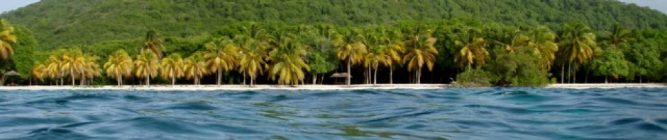
For their first day I suggested we all have a look around La Paz. John and I hadn’t really explored much of the city. We started walking along the Malecon, the long, long waterfront of La Paz.

The La Paz Malecón

is a 5 kilometer ocean front broardwalk or promenade. It serves as a, safe, pedestrian-friendly walking and biking path. It is lined with restaurants, and shops, on one side.

The other side of the Malecon and has sculptures plus a view of the beaches, the anchorage and harbour.

We walked along enjoying the sights while chatting. The playground area was a hit with Lily and Eve.

While I really enjoyed seeing the statues made from weapons. 

After crossing over the road, we happened to be in front of a typical Mexican ice cream shop. I suggested we get an ice cream, the girls were very happy with this suggestion.

The ice creams were wonderful! Made from different fruits they could even be said to be good for you. We all enjoyed sitting in the shade eating our cones, popsicles and small ice cream tubs.

Katie wanted to visit the cathedral, off we set towards the city Centro to where the cathedral was located. Along the way I admired the murals. I simply love the numerous Mexican murals. 

At the cathedral, Catedral de Nuestra Señora

we all looked inside at the historic displays. Named, Catedral de Nuestra Señora aka Our Lady of Peace it was Built in 1720. This church has both historical and architectural importance for the city. It is located on the site of the mission founded by the Jesuits in the 18th century. 

All of us had a good look around the cathedral, enjoying the historic relics and the quiet atmosphere.

Next stop was:

The centro market, Mercado Municipal General Nicolás Bravo

(often called “Mercado Bravo”), which is located in the city center (El Centro). 

I found it to be much smaller than many central city markets we have visited elsewhere. However, markets are great for an authentic local experience, fresh fruits, food, butchers, merchant of all types and traditional meals. All of which we experienced first hand, for example,

Lily and Eve both did not like the smells from the fresh fish stalls. I think it was a bit rough for them. Meanwhile while taking a look around, I purchased some wonderful mangos and tangerines. 

Gavin and Katie wanted to experience real Mexican market food so we sat at a food stall for lunch. I think they ordered every item offered just to experience them.

The food was a real hit with everyone. There was a choice of:

. Empanadas: A highly recommended staple in the market.

. Gorditas: Known for featuring various stews (guisos). 

Sopes de Machaca: Sopes topped with regional shredded dried beef.

. Tacos: Specifically fish tacos (tacos de pescado capeado).

. Burritos: Various fillings.

. Menudo: A traditional soup, sometimes served with corn grains. 

I had a simple empanada and was tempted by the beans. 

Meanwhile behind us I noticed the fresh fruit juice stand.

Loving the fresh juices one can get I chose to have a mix of veg and fruit. It was delicious. A few of the juices offered were:

La Verde: A popular green mix including pineapple juice, nopal cactus, and parsley.

El Vampiro (The Vampire): A nutritious blend commonly made with beets and orange juice.

Carrot Juice (Jugo de Zanahoria): Frequently available, often mixed with orange or apple.

Lily chose a mango milkshake and Eve a strawberry shake.

Back towards the marina we strolled.


The destination for the 2nd day, Tuesday:  Isla Espiritu Santo, Holy Spirit Island. 

We were going with the tour group that I had previously researched:  https://alonsotours.com/ 

Our tour was a private one with a captain and a guide who was a marine biologist from Reunion Island, his name was Flo. The boat was your basic tour boat with a small, “white house” aka the head.

On our way out of the harbour we passed a large, white, rocky, island next to a fish farm. John and I had previously been curious about the area as the island looked barron and forlorn. 

Flo explained that the bare, rocky, white Isla was covered in bird droppings/guano. The isle was protected as it was very important to the local ecology/environment. The bird guano feeds the organisms in the sea that it washes into, which in turn feed the micro organisms and sealife – (is a short version of what he said).

We passed by quite close and could spy, Blue Footed Boobies, and numerous other birds. The island while looking dead was actually full of life.  

 Gavin asked about Bahía Balandra. He had read about it and was curious. Our captain Jose accommodated Gavin’s curiosity by doing a detour to show us the bay, which is on the mainland.

It is a famous, magnificent bay. It is a protected natural area known as one of the country’s most beautiful, unspoiled beaches. We saw the famous mushroom rock, Flo told us that a few years back a visitor climbed on it and broke the top off with his weight.

The rock was repaired and is not to be touched. Everyone was very impressed by the bay and hoped to revisit it.

Off again, we headed to another enormous bay Bahia san Gabriel, on the shores of Espiritu Santo. Here we visited a bird sanctuary which was by a mangrove lagoon. Another protected area, only listed tour boats can visit, but not to anchor, just entering to see the bay. 

Flo told us about the importance of the bird sanctuary and also the mangroves to the health and survival of the sea-life. There was a colony of the Magnificent Frigate birds that were nesting. We could see the adults and the babies. 

In the next bay we went turtle searching. By following the deeper water towards the shore we were able to look out at the turtles that were resting on the surface.

There were numerous turtles of many sizes. The girls were thrilled to see them.

The  Los Islotes, (often called “La Lobera” or “The Rookery”), are at the northern end of Espiritu Santo and Partida. They are home to a permanent colony of over 500 California sea lions and seals.

Here visitors can snorkel with them when with an approved tour group, as the area is a national park and totally protected.

We arrived excited, not really knowing what to expect, just looking forward to the adventure. There were a large number of seals and sea lions sunning on the rocks, plus some laying on the surface of the water with their fins sticking out.

Flo told us this is how they sun bath in the water, regulating their body temperature with a fin out. 

It took a few minutes to get ready with our masks snorkels and fins, (we had to wear life jackets as we hadn’t brought our wet suits). Then over the side we went. 

Instructions were to stick with Flo, listen to Flo, and not to approach the seals and sea lions, just observe. The boat operators do not anchor, but hang off close by. 

Snorkeling with a life jacket was challenging, but do-able, the water wasn’t as clear in some areas as others due to it being nutrient rich plus the differing thermal layers. 

We were able to see the seals that were floating near us. Plus see the others on the nearby rocks. It was quite thrilling, but also very chilly. 

We followed along the Isla approaching a tunnel. Here the current increased and we were told to glide through the passage not touching the sides which were covered in brightly coloured sea-life.

 Back out the other side Jose and the boat were awaiting us. The girls were frozen but happy. We all bundled up in towels while off we headed to our next destination.

A lovely beach in Ensenada del Candelero for lunch was our next stop. 

We climbed off the boat and strolled the beach while the guys set up our lunch. The lunch was delicious! There was the best ever fish ceviche, plus tostitos and nachos, sandwich making foods, fresh fruit, cookies, and drinks just everything we would want. 

Everyone the girls included feasted on the ceviche with tostitos. It was a best ever lunch, but then again we were all starving from the cold water activity. 

I was also impressed as everything was reusable, there were no plastics or throw away items except for the aluminum cans. Lunch finished we all explored differing areas of the beach.

The girls looking for sea-life in the shallows and shells on the beach. Flo joined them for a while showing them and telling them about baby sea urchins in the shallows. 

Our guide Flo suggested going to a nearby beach for a snorkel to see the reef.

The snorkel was in my mind going to be disappointing from what I had seen in the past snorkels in the Pacific. Well I was really surprised! And this time we didn’t have to wear the life jackets. The area was covered in coral, not the differing types like in Bermuda, but a tall delicate tree like corals. 

There were fish galore some were brightly colored, others like the needle fish of differing shapes. All swimming through the corals and rocks. 

Flo pointed out a poisonous starfish, some large sea urchins and an eel which was hunting its prey.

Plus other fish of interest like trumpet fish. He also told about what fed on what and how they were all reliant on each other.


It was a wonderful day out with our excellent marine biologist guide and organized driver, Flo and Jose.

That evening we all had dinner at the restaurant at the marina. A lovely meal and good conversation finished off the day.

Wednesday, day 3

 Gavin, Katie and the girls went off to visit a museum, which they said was excellent. The whale display showed exactly the story that Flo had told about the whale which tried to catch a seal at the seal colony and ended up stuck in the rocks. They even got to see the skeleton.

They visited other parts of the city and later in the afternoon John visited them for a swim with the girls in the pool.

 Meanwhile we got our laundry in and our shopping/restocking more or less completed.

And we finished the say off with a barbecue at the Airbnb with the family. Gavin cooked an excellent steak!

Day 4, Thursday, Aeeshah for the day.

This was a day out to the famous Ballandra Bay aboard Aeeshah. I admit I was reluctant as I thought they would be bored silly as it takes over an hour just to get down the channel. However the day was a great success. 

Katie, the girls and Gavin arrived at Aeeshah and we set off 9:15ish planning according to the tide that runs in and out of the harbour. Out on the out going, in on the incoming, the current is surprisingly strong.

 The girls were happy to be allowed their iPads down below. They were doing their homework and such.  We passed all the hotels, marinas, resorts, ports and all else that lines the long channel. 

Reaching Balandra, famous for its shallow, crystal-clear turquoise waters, white sand, surrounding desert mountains, and the iconic “Balandra Mushroom” rock formation. It was a pristine paradise day, with blue clear sky for us to enjoy.

Everyone was keen to head ashore, John dropped the dinghy and took Gavin, Katie and the girls ashore to one of the deserted beaches within the bay.

Next he returned for me. We left the dinghy on the beach and set off to follow them and enjoy a walk along the sands looking for shells and whatever we could find. 

In the distance we could see the crowds filling the main bay for their half day on the main beach. By road one gets either the morning slot or afternoon, 450 persons at each time slot for a fee.

We walked along the rocky shoreline and into the shallows being mindful of the stingrays we had heard about. It was a lovely morning.

Back to Aeeshah for lunch. I set up a buffet style lunch. Having just shopped we had fresh stick loaves plus salami and cheese, fruits. Katie and Gavin had brought his spicy salsa, nachos, cold meats and more. Meanwhile John got the paddle boards inflated and ready to go.

Off they went Gavin and Lily on one and Katie and Eve on another. They went all over the shallows of the bay, to the beach and more. 

John and I straightened up and set off in the dinghy to see the rest of the nearby bays and shoreline. We passed the famous mushroom rock, plus saw schools of rays gliding along in the shallows of the bays. 

Once back at the boat we told the family about the fever of rays and they headed out in the dinghy to find them.

(researching the group of rays I had found that: “A group of stingrays is called a fever this term is used to describe the large, synchronized gatherings of stingrays).


They were really lucky to spot several schools of them too, the girls were thrilled.

Time to head back, it was going to be a long, hot, hour-long, slog, back to the marina. That was until we spotted whales breaching in the channel. There were numerous whales breaching, jumping high out of the water, slapping the surface, playing.

The whales really looked like they were fighting or rough playing, leaping high next to each other splashing their fins and tails. Lily and Eve were amazed, We were all thrilled to be able to watch the show they put on. So the return journey turned out to be quite thrilling.

Day 4 Friday

There was an Art gallery, that Katie fancied seeing, Museo de Arte de Baja California Sur. The artwork and murals were wonderful they reported back to us.

After which they did a bit of a wander around. 


Us meanwhile got Aeeshah back in order, plus tried to figure out what to do about John’s missing phone. He had left it in his pocket when he went over board to the seals and lost it in the deep blue. He was well and truly stuck as all his info, online banking etc was not retrievable ….so we thought.

Day 5 Saturday: Off to the Whale Sharks

This our Whale shark adventure day. Gavin arranged for us to go with the same tour company, Alonso tours. This time we were with a group of other folks because that is how whale shark swim tours are conducted. 

Swimming with whale sharks in La Paz, is a must do, eco-tourism experience available just between October 1st to April 30th. The Parks Authorities control the bays, the numbers of tourists per day etc. Tours, normally led by marine biologists, allow snorkeling with these gentle giants that are up to 12m long, in the shallow, nutrient-rich waters 

We chose to wear our wet suits this time. The tour boat took us to the area where at this time of the year the whale sharks feed. He told us that the water is shallower so there would be mainly juveniles that we would swim with. 

Arriving at the site we all were more or less ready, suited up, with our masks snorkels and fins ready to take the plunge. Our instructions were to not go in front of the swimming whale sharks as they just keep going, slowly, smoothly, whether you are in their way or not. Not to touch them, to keep up with your group, listen to instructions and swim back to the boat if you have a problem. 

There were 4 of us to a group. Gavin, Katie and the girls were in group 2 and John and I in group 3 with 2 other adults. 

So we had to sit on the side of the boat and all together now, “1, 2, 3! Jump in!”

Once in the water the whale shark would be gliding towards you. 2 of us on each side would swim as fast as possible to keep up with the shark swimming along side. I’m not sure how long each swim was lasting, but basically just about as long as I had the stamina to last. The girls were amazing, they kept up with the shark, hardly tiring, and never had a problem. (The other children in our group quit after the 1st swim)

The sharks swim effortlessly, just moving their tail, never wavering. Their beady eyes just staring out, as they glide along with their mouths slightly open to catch the nutrients.

Our guide took some GoPro videos for us to have of the whale sharks. He too was an excellent guide.

We all did 4 group swims, which were thrilling! 

Whale sharks are amazing creatures. 

Here are 1a few facts about them from a diver blog:

World’s Largest Fish: The whale shark is the largest extant fish species, with some individuals measuring over 60 feet (18m) long and weighing over 40 tons. Scientists believe they live for a long time, potentially between 70 to 130 years.

Whale shark video from our trip

Filter Feeders: Despite their size, they eat tiny critters like krill, shrimp, and fish eggs, filtering them through their massive, up to 1.5-meter-wide mouths.

Whale shark video, encounter from our trip

Unique Spot Patterns: Every whale shark has a distinct, unique pattern of light spots and stripes on its back, used by researchers to identify individual sharks.

Slow-Moving Migrators: They are gentle swimmers, often moving at only 3 mph (pastedGraphic.png5km) per hour, but they can migrate thousands of miles to feeding grounds eating krill, crab larvae and other tiny critters. 

Small Teeth, Large Gills: They have around 3,000 teeth, but they are tiny (pastedGraphic.png1 inch long).and not used for eating; instead, they filter water through mesh-like gills.

Unique Eye Protection: Unlike eyelids, whale sharks have denticles (tiny teeth) on their eyeballs to protect their eyes, allowing them to retract their eyes for safety.

The Mystery of Birth: Very little is known about their mating and birth, as only one pregnant female has been officially examined, which revealed they are ovoviviparous, meaning

It was a wonderful experience, one none of us will ever forget!

After the whale shark swim we stopped by the tourist market and had a look around. Plus made some purchases.

The last say had arrived, Gavin, Katie, Lily and Evie came to Aeeshah to spend some time before leaving for the airport. We all walked back to the Airbnb, hugged said our fond farewells and off they went for the long journey back to Bermuda.

Being me I asked each of them a few questions about their time in La Paz with us.

Eve:

My favorite adventures were:

1st, Swimming with the whale sharks.  I liked  swimming with whale sharks because we have never ever swam with them. They are beautiful and I wasn’t scared.

2, Seeing the whales jumping. Seeing the whales jumping in the sea was special because I’ve never seen a whale jump so close to me before. 

3. Seeing and swimming with the seals and sea lions.

I liked swimming with sea lions, even though it was really cold. It was really amazing.

What were your favorite foods: Ceviche and the guacamole

Lily: 

My favorite adventures were:

1, Seeing the whale sharks. I liked swimming with the whale sharks because I don’t get to even see them in Bermuda. And I was right next to them.

2, The day we saw whales jumping in the sea nearby. It was exciting I’ve never seen whales so close before.

3. The school of stingrays. I’ve never seen anything like groups of stingrays before.

Favorite foods, “That’s a tough one. I’ll have to think about that….. Probably the tacos.”

Katie:

1. Swimming with the whale sharks. It was so incredible to be next to such a large animal and have it be so peaceful. It was a memory I will keep forever. It was a lot harder to keep up with them than thought it would be! I was also, so proud of the girls and how brave they were swimming alongside the whale sharks

2. Our day out on the sailboat Aeeshah and going to Balandra beach. This was such a great day. I loved paddle boarding in the shallows of the area. The giant needlefish were great and the packs of stingrays were wonderful to see. Plus we saw whales jumping on the way home. It was a great day out.

3. The snorkeling off and near Espiritu Santo. Firstly, the deep area when we went through a cave at the end of the seal lion swim. Secondly there was great snorkeling after lunch. I loved seeing the garfish and trumpetfish, there were so many there. Holding the girls hands while they snorkeled and explored the sea always makes me so happy.

4. You didn’t ask for a 4th, but our last night in La Paz was just awesome. We walked down the malecon at night which was full of vibrant music and families enjoying the sunset. We had a great meal of fresh fish! And as we walked home we stopped to buy for paletas (popsicles). Those paletas are divine, so fresh with real fruit! We laughed the whole way home and it was a perfect ending to a great week.

Gavin:

(I decided to go off script and pick my 2 favorite days)

Our big tour was fantastic and having our own boat and such a knowledgeable crew was perfect. I think that was really the key part of the trip as it reinforced that we really wanted to go back to one of those beaches and spend more time there. It was the best way to see Espiritu in its entirety. Such a beautiful place and so full of life in the ocean. The contrast to the desolate land was what made it so unique. That day paved the way for my next favorite day.

Which was when you all took us out on the boat to Playa Ballandra. that was great for two reasons, firstly, because I think it really showed the girls how you live being on the boat as opposed to just visiting, but also it gave us some time to really enjoy one of the most amazing beaches. Had we gone by shore, along with the masses, we never would’ve had access to a dinghy or the paddle boards not to mention being able to enjoy some shade and a nice lunch!

The whale sharks were an amazing and exciting adventure, but those two days really will be remembered by all. Thanks!

It was a wonderful week, that I’m sure we will all remember and treasure the memories.

“Family is where life begins, and love never ends.” — Unknown

Posted in Weather | Leave a comment

Puerto Espandio mooring field, Agua Verde, Timbabiche,  San Jose, Bahia Amortajada, Ensenada Cardonal, on Isla Partido, Falso Bay and La Paz anchorage

PHOTOS — >>> https://photos.app.goo.gl/QRJe48w5jd1PgkrUA

Puerto Espandio Marina and mooring field,

After a roughish passage, we once again we entered the mooring field and checked into the Marina. The mountain view’s were spectacular and a constant reminder of the beauty of the area.

Our days in the mooring field coincided with some exceptionally windy, weather. The cold, winds blasted down off the mountains.

One of the days we didn’t even venture ashore to the marina. 

Again I tackled the laundry. This time being lucky with an empty laundry room. We enjoyed a few meals at the restaurant and walks around the marina area.

We hired a car for the day and drove into Loreto to resupply. Again having enough time to walk through the historic zone and have excellent fish and chips at a lovely restaurant. 

After 5 days we were ready to leave Puerto Espandido mooring field and resume our southern journey

Agua Verde 

 “Agua Verde is a remote, scenic fishing village and bay located in Baja California Sur, Mexico, known for its turquoise waters, white sand beaches, and dramatic, mountainous landscape along the Sea of Cortez. It is a popular, secluded destination for adventure travelers, sailors, and campers looking for snorkeling, fishing, and hiking nearby.”

Another post described it as “the land that time forgot”

It is another very large bay with smaller bays inside the main bay. We had one of the beaches in front  of us and cliffs along side, plus several other bays off in the distance.

Determined to make the most of our time here we set off the next morning hoping to hike to the cave drawings – petroglyphs that I had read about.

We pulled the dinghy high up on the beach, below where there were a few campers parked and set off up what I guessed was the trail.

After a steady uphill which afforded lovely views of the anchorage, we crested the hill and descended a steep rocky pathway.

At the bottom we found the small graveyard that I had read about. It was the graveyard that was the 1st landmark for this hike. Apparently it was the nearby fishing village’s graveyard. Many of the graves dated back to the early 1900’s. 

Setting off again we followed a sandy track that was obviously used by village trucks and cattle. It was through brush with many animal trails leading off into the prickly undergrowth.

We basically guessed which way to go, but we found our next landmark. This was called the oasis, the small green waterway that the area was named after.

Agua Verde – Green Water. The area had obviously been somewhat trampled by cattle, however it was a small green oasis in the middle of dry brush land. 

Next we headed to the beach, again it was guesswork which path to follow. By this time it was also quite hot with full sun blazing down on us. We reached the bay and looked for the cliffs where we thought the caves might be……but after hunting we had to concede that we could not find them.

The cliffs and rocks were themselves quite interesting with unique formations. After a short rest we headed back.

The hike back was steep and hot, but again the views were lovely.

Once back at the beach we started chatting to a few of the campers. One fellow told us that to reach the cave paintings we should have walked to the other end of the beach from the oasis and then climb upwards…..oh well, next time.

On our second day at Agua Verde we were awakened around 6:45 by all types of racket coming from the shoreline. Looking out the rocky shore was full of men and boys with white buckets, white boots and fishing gear. I found out later it was a father teach son how to fish event put on by the village Dads. Everybody certainly sounded happy.

After breakfast we headed off from the same beach for a hike up the headland. This was a very pleasant hike and the views across the islands, anchorage and mountains were spectacular.

Parts of the trail were quite rocky but generally speaking it was an easy trail. This day I was hoping to spot the wild mules/burros. We spotted plenty of fresh droppings, heard distant brays, but again they were not spotted. 

Mules are integral to the cultural and agricultural of this area of Mexico, within the traditional “ranchero” culture. Due to the rugged, arid terrain, they have historically been preferred over horses because they are better adapted to browse on sparse vegetation.

I really hoped to see the ones we could hear. However, we struck out.

After hiking up to the peak area, we next walked the shoreline of the adjacent isle.

The tide was low and the shoreline easy to walk along. Another lovely outing.

Timbabiche

An anchorage I chose as our next stop. I had read about an abandoned mansion and the story behind it and had hoped to explore the area. Plus there was abundant bird and sea life to be found along the shoreline. 

The abandoned, old, manor house has been there since before the Mexican Civil War (1910-1920). The story behind the house was that a fisherman/pearl diver, found a massive pearl and spent his fortune building the manor house for his family.

This is a similar story to John Steinbeck’s, “The Pearl”. And, yes, Steinbeck also travelled this region in the 1940s.

However, not happening, John didn’t feel like getting the dinghy down and going. He chose instead to head off paddle boarding on his own. 

I did get to see the mansion in the far distance and some bird and sea-life from a distance too. Hopefully there will be a next time in this lovely anchorage. 

San Evaristo

The lovely fishing village was our next stop. We anchored in the main bay with the Sierra de la Giganta mountains behind us. 

Off to the shore we headed for a late lunch at our favourite restaurant. Everything was the same as last time. Fishermen were seeing to their boats or cleaning their catches. Hundreds of sea birds of all types were following the fishermen. 

We pulled the dinghy up in front of the tiny tienda and went next door to the restaurant for lunch. Both of us had fish tacos which were delicious! After lunch we popped into the tienda and headed back to Aeeshah. We had planned that the next day we were going to head to the cross on the hill, but we headed out instead. The weather dictated that we needed to move on.

San Jose, Bahia Amortajada

Bahía Amortajada, (sometimes referred to as “Chopped-up Bay”), was reputed to be a serene bay, but was known for having a massive mangrove lagoon located on the southwestern tip.

These types of extensive mangrove forests are rare in this part of the Sea of Cortez. They provide a nursery for various marine life and birds.

There were also reports of clouds of biting insects that come out at night, and descend on boats even entering via screens in order to bite human victims. Maybe explaining the Chopped up Bay nickname. 

We had decided to anchor some distance from the mangrove lagoon on one of the huge migrating sand bars. 

That evening we had a nice breeze and so having the boat semi closed up should have meant we would be safe from the flying biters. However, John got bitten. He managed to get several bites which he said itched like hell. I was spared, maybe because I worn my long pants etc. 

Right after breakfast we headed off to explore the lagoon and mangroves. We timed it to coincide with the high slack tide as the cut is impassable otherwise. The channel in was still running water, but was an easy entry. 

The mangrove forest as it is called was indeed enormous. We only saw the very outskirts. 

There were these large, long fish swimming just under the surface. I believe they were : Needle fish

Needlefish ( Tylosurus crocodilusand ) and cleanerfish (Labroides dimidiatus).

Needlefish (Strongylura): These fish have long, slender bodies and long, thin jaws filled with sharp, needle-like teeth. They are piscivorous, meaning they eat small fish, and are commonly found swimming near the surface in shallow, brackish water of mangroves and coastal bays.

We also spied several large turtles swimming in the shallows.

And several different species of birds. The most prevalent were the Snowy Egrets. A smaller, active heron with black legs, black bill, and distinct bright yellow feet. 

A highlight for me was to see a pair of nesting ospreys in a nest at the far side mouth of the lagoon. They are fish-eating raptors that dive feet-first into the water to catch fish.

Their cry is distinctive and we have often heard and seen ospreys along our route. However this pair just watched us from their nest as we passed. 

The area was very peaceful and beautiful.

From leaving the massive, mangrove lagoon we went along the beach shoreline and landed the dinghy. I wanted to visit what had been referred to as the “cactus forest” on San Jose.

Miles and miles of giant cactus. It is a known as remarkable, natural, habitat featuring dense populations of the Mexican Giant Cardón (Pachycereus pringlei), which is the tallest cactus species in the world.

  This forest was full giant cacti, which can grow to over 60 feet tall and live for hundreds of years.

However, they do not grow side by side as in a forest of trees, but they support their own ecosystem of plants around them and so are spaced out accordingly. And again, every single plant has thorns. 

We followed a wash, an area when it rains water washes out, into the cactus forest.

It was interesting seeing all the differing cactus, and shrubs. Some shrubs were even blooming, others seemingly dried out looking dead.

It was hot, the sandy ground was particularly dry and hot. We saw different animal prints and I wondered how they survived this harsh environment.

After the cactus forest we walked along the lovely beach and returned to Aeeshah. Where we up anchor and departed, heading to nearby:

Isla San Francisco

The anchorage is very popular especially with the charter boats. So as usual there were plenty of other vessels there, many of them large mega cats. We just stopped this time for a bug free night and then headed off. 

Ensenada Cardonal, on Isla Partido

We crossed over to Espiritu Santo and Isla Partida deciding to anchor in Ensenada Cardonal, on Isla Partido.

Espiritu Santo, (Holy Spirit Island), and Isla Partida are the two islands that make up the Espiritu Santo Natural Marine Parks a stunning, uninhabited UNESCO World Heritage site near La Paz.

 At the very north of them is Los Isotes where there is a sea lion colony. We cruised past slowly trying to see the seal lions and seals from a distance.

Only licensed tour operators are allowed near the Los Isotes. We could hear them barking and Chico was very interested in them.


Ensenada Cardonal was our stop over bay. Another huge bay, shaped similar to a Norwegian fiord with rugged cliffs on either side and a beach at the end. 

We had been here before and so our dinghy explorations took us into the neighboring El Cardoncito bay and then onto Partida bay. We passed below very dramatic cliffs and rock formations which really are surreal. 

Bahia El Cardoncito was in a deep but shallow bay. We anchored the dinghy off the beach and waded ashore. John went off rocky cliff climbing.

I walked the bay and as usual found some interesting shells. The most wonderful one is a Nautilus shell. It is absolutely amazing how this shell was still intact. 

In Bahia Partida we cruised along the shoreline looking at the crazy rock formations and at the lovely bay. To go ashore would have meant a long wade in shallow water, not feeling like doing it, we headed in the dinghy back to Aeeshah.

Falso Bay and La Paz anchorage

Over the next few days we went via Falso Bay and along into the La Paz anchorage. We had just 6 days to prepare for Gavin, Katie and the girls who were visiting……yikes!

“Silent; to be alone. All the being and the doing, expansive, glittering vocal, evaporated; and one shrunk, with a sense of solemnity, to being oneself…When life sank down for a moment, the range of experience seemed limitless.”

— Virginia Woolf

Posted in Weather | Leave a comment

Mulege, Santa Domingo, Punta Pulpito, Bahia San Juanico and Isla Corriados south

PHOTOS —>>. https://photos.app.goo.gl/iw7YuNVTLARQphN99

Mulege

We zoomed off to Mulege in Santiago’s little red car. He dropped us in the town center where we set off to enjoy Mulege. 

Mulegé’s name is derived from the Cochimí phrase “Mulejé”, meaning “Large Ravine of the White Mouth”.

This was in reference the canyon walls that hold the Río Santa Rosalía, the river that flows through the town. The town was originally founded as a Jesuit mission in 1705.

We wandered the narrow streets enjoying the quiet, friendly, atmosphere and headed towards the old prison on the hill. 

Sin Rejas or La Carcel Sin Puertas

AKA…. known as the “Prison without any doors”.

 This prison was reknown for its unique, open-style. Prisoners were not kept behind bars and were trusted to roam, encouraging a system based on rehabilitation rather than strict imprisonment. The inmates were allowed to leave during the day to work, visit family, or assist the community.

There were no doors, as the prison consisted of open cells, and the primary “security” was the remote location and lack of social contact. It functioned for about 70 years, operating as a unique, trust-based penal experiment.

We climbed up a small hill to the prison and found a very plain looking building with nice views across the town. We paid to go in and look around.

The exhibits seemed to be in the middle of being refurbished, plus there were signs that the structure was being repaired. 

The cells were very small, I cannot imagine having to stay in one. Some of them had displays of memorabilia from the past.

John was fascinated by the display showing where and how the prisoners were executes by firing squad against a wall. I just found the prison a bit depressing.

Next stop was:

Misión Santa Rosalía de Mulegé

We headed across town and across the lovely Río Santa Rosalía towards the Mission on the hill that we could see in the distance.

Passing some very interesting properties. One had been built around a tree which we both found amusing.

Another was just so lovely with its murals and flowers, it was a real picture, flower, garden.

Climbing up the hill the mission building was quite impressive. This Misión Santa Rosalía de Mulegé was a cornerstone of Spanish colonial efforts in the region.

Unfortunately the building itself was not open. We walked around half of the outside and then climbed to a look-out post. The  iconic red-stone church, overlooks a lush palm oasis that contrasts starkly with the surrounding desert.

The views were wonderful, the contrast between the green oasis and the distant dessert stunning.

Constructed using local stone, the mission building has been restored and features a notable, well-preserved, rustic exterior that reflects its historical significance. Apparently, the Jesuits aimed to establish a self-sustaining mission that provided food for other missions in the region while converting the local Cochimi population to Christianity.

We finished our walk around the mission and then headed into Mulege for a bite to eat followed by grocery shopping and a ride with Salvador back to the anchorage.

We also took a dinghy and toured around the entire Bahia Conception.

There are many bays, all of them beautiful, each offering shelter from different wind directions. Some of them have camp grounds for RVs others have guest houses.

Many of them are very shallow especially along the beaches. We liked several of the bays but decided that where we were was the most sheltered from the northerly winds that had been dominant.

Santa Domingo

At the head of Conception was our anchorage for one night. It was just an hour away and a good vantage point for the following day. Having gotten there quite early we went ashore for a look around. 

We did walk the beach area, but then got drawn inland up a trail. The area is used a camp site for rough camping and we found many pathways and ATV, 4wheel drive tracks too. 

Being above the beach there were very nice views of the entire area. I ended up in a wash, an area where rain water had eroded the rocks and the wind had funneled through causing or making unique formations. 

Following the wash back to the shore and then back along the beaches was a very enjoyable walk.

Punta Pulpito

This anchorage was below some very impressive cliffs. Our reason for being there was to explore the sea caves, plus to get ashore and hike up to the top of the ridge.

However, we couldn’t get ashore. The wind blasted down from the heights, the beach was just boulders and the seas were rough. We decided to wait till next time we pass this way.

Our next passage was one that was unlike any we had ever had. We had seen a bank of fog off shore, but set off anyway, thinking, oh, it will pass, it will disipate.

However, the fog came down on us and of course we could not see ahead and had to rely on our instruments and radar.

John set the radar to highly sensitive and crazily it was even picking up flocks of pelicans flying by. So, a passage that was supposed to be short turned into one of several hours with us creeping along. 

Next, we caught a fish, of all times to catch one, but it ended up being our dinner and was excellent. 

Bahia San Juanico

We cautiously made our way into the bay again using our radar, peering through the fog we could see other boats, but getting a field of depth for distance was not easy. We found an area to anchor and were very relieved when we were grounded and secure. Of course the fog started to lift and within an hour it was bright sunshine again.

On our first day in Bahia San Juanico we went ashore and followed a trail that lead down a typical dusty, sandy, track through the brush and cactus.

I was hoping to see the wild mules/burros that I had heard about from another boat in the anchorage.

This track lead us to a beach on the other side the bluff.

Again there, there was a small camp ground, but no sign, other than droppings of any wild mules.

After a walk along the beach we headed back along the very unimpressive track.

Heading back uphill we took a detour to a peak that looked out over the anchorage. There view was wonderful, but still no mules.

Day 2 in Bahia San Juanico

Taking the dinghy across the bay to the furthest beach on the other side to see what was there…..we found a very nice area to walk and explore.

The beach was normally a windward one but this morning all was still calm. It was a beach that was backed by sand dunes.

Those dunes were really steep to climb up, the sand was very loose and so it was challenging for me.

However the slippery climb was worth it. From the top of the dunes there was a great view of the anchorage, plus I could see what was in the distant bays too.

John walked to the rocks at the very end of the dunes, I kept more to the top edge.

Walking along the dunes I saw many different animal paw prints, maybe coyotes, possibly rabbit too, but no mules.

We finished the walk by going to the far end of the beach.

 I was very happy to find a great variety of shells! The whole walk was delightful. 

Isla Corriados south

We had a very, windy, passage to Isla Corriadas south. The seas were quite disturbed as the was current against the wind which was blowing up to 20kts.

We basically stopped for shelter and so were very happy to find it much calmer and quite sheltered.

We just stayed for the night and then were

off to: Puerto Espandio Marina

“There are times when we stop. We sit still…We listen and breezes from a whole other world begin to whisper.” —  James Carroll

“Everyone is given one gift, a reason for being, and it’s our obligation to do something with it.”

Posted in Weather | Leave a comment

Isla Carmen, Bahía Salina, Punta Perico, Isla Coronado, San Juanito bay, Punta Santa Domingo, Playa Santispac


Isla Carmen Bahía Salina

Isla Carmen PHOTOS: https://photos.app.goo.gl/5yJSS9mUgRXzafQB8

And the rest PHOTOS:  https://photos.app.goo.gl/Qj

Was our next anchorage. Yes, another salt mining area on an island. This area was very historically significant for salt production, starting in the early 18th century (1717) and continuing until the 1980s. So, this salt mine, John assured me was special. 

We had read that we could explore abandoned structures, including workshops, a chapel, a cemetery, and rusted machinery from the salt industry, but first we had to check in with the caretaker.

Once ashore we found the caretaker behind the first set of buildings. He was friendly and happy for us to go exploring.

There was a very large salt field, stretching way off to the base of the mountains.

We walked around the salt ponds, at all the differing pools of colour and by the salt creations made by the dried salt.

The hot, dry climate around the Sea of Cortez makes this quite an efficient process. 

Salt production at Bahía Salinas on Isla del Carmen has a long history: In 1717 Juan María Salvatierra, who also founded the town of Loreto, got permission from the King of Spain to start a salt extraction operation at Bahía Salinas.

The King of Spain was of course also the King of New Spain, comprising all the Spanish colonies in the Americas. This salt is pure enough to not need any purification before its consumption.

The salt production grew, and in 1867 the “mine” had produced a total of 35,000 tons of salt.

In the 1880’s, machinery was introduced, and rail tracks were built as well as a dock for shipping the salt out. In 1890 the salt prices fell and Bahía Salinas became less profitable.

The mine changed hands several times over the next many years until finally in 1984 the salt production ended.

We explored the old abandoned buildings and machinery which John found fascinating.

This area is now called a ghost town, mainly in reference to the lack of people. I enjoyed looking at all the unusual “decorations/additions” that were placed around the building. 

 The caretaker had told us they were expecting guests the following day. The area and mine is privately owned and the old salt works are now used as a hunting lodge, where hunters can book a stay to hunt big horned, wild sheep that live on the island.

For me the irony is that the Big horned sheep were put there as a breeding program due to them being endangered. But, now they are hunted. Hunted apparently for huge amounts of money, by the wealthy no doubt.

 The lodgings of the hunters and the staff are buildings from the time of the salt extraction that have been restored. They are expanding and we saw several ruins that were in the process of being restored.

It was a very pleasant morning wandering around the old salt works which was indeed different to the others.

Punta Perico

Was just an over night anchorage for us. The particular bay we were in was very rocky and offered nowhere for us to anchor the dinghy.

We promised to return to the area, but to anchor in the South Bay instead. The shoreline cliffs were attractive and we were well protected from the north winds.

Dolphin video:   IMG_2881   

Isla Coronado

This was our next destination. It is stunning, uninhabited volcanic island located just off the coast of Loreto.

It’s nickname is, “Jewel of Loreto,” and a very popular destination for the Loretto locals and tourists. It is famous for its white-sand beaches, crystal-blue waters, sea lion colonies, and abundant marine life.

 So, yes, during the morning and early afternoon there were many pangas arriving and off loading folks, but we still enjoyed our time in this bay.

We landed the dinghy on the beach and headed down the trail towards the volcano hike. It was a ways across the island we followed a windy well laid path. Until we came to the rocky slopes of the ridge line.

I was game to try to climb the rocks, but John was reluctant for me to climb up a rocky slopes and down with the chance I might compromise my knee by slipping…then we would be really stuck.

Therefore we headed back to the pathway that headed across the isle. Again a very nicely laid windy, pathway by the parks folks we followed to the other side.

There we looked out from the cliff across a beach to the ocean beyond.

We continued along this pathway for quite a ways until we realized it only headed to the tip of the island. Back we headed to Aeeshah. A nice walk through the shrubbery. 

Around about this time I started to feel unwell. Little did I know what was to come.

San Juanito bay

Bahía San Juanico, aka Scorpion Bay, is a large, remote, lovely anchorage. We only stopped for one day and only went for a dinghy ride around the area.

It comprises of many small bays separated by rock formations, many of which are impressive. The bays are also popular with campers as we saw many parked ashore. We promised to return and spend time exploring the area.

Punta Santa Domingo

This bay is at the entrance to Bahía Conception and where we stopped for the night.

As per normal another huge bay and very beautiful.

We did go ashore in the dinghy, and I did attempt a walk. However, I was feeling very ill and didn’t really enjoy myself.

John walked down the rocky beach, then we returned to Aeeshah.

Playa Santispac

A really lovely bay where we anchored under the shelter of some high land to be in the lee from the winds.

When we arrived I was finding it difficult to breathe, my throat was incredibly sore, my head and chest was full of muck…..things were not good. I had to see a doctor. 

Luckily there was the town of Mulege about 15 miles away. Then with the help of information I got off of the Noforeignland app, we secured a taxi driver, Salvador. 

We went ashore and met Salvador in the campground car park. He drove us into Mulege to the hospital/clinic. Salvador came inside with me, took me to the receptionist, went with me to see the nurses, the doctor and did an amazing job of translating for me. He made sure that I understood everything and really took care of me.

 I had viral infection of some type, aka flu, Covid or some such.

The real surprise came when we went to pay, all they needed was a donation. Yep, medical is free, John left a good donation. 

Next we were off to the pharmacy to get my meds. Again Salvador came in with me, he made sure I got the exact meds necessary from the pharmacist. The meds were for 5-6 days and were for my chest and sinus relief, plus paracetamol. Salvador made sure the instructions were clear for me by writing them out clearly in English. Again he was wonderful. I told him he was my hero!

We next drove to the bank and he would have taken us to the shop too, but I really needed to get back and rest. Salvador was absolutely wonderful! He was so very kind and understanding, AND he didn’t even know me.

Over the next few days I basically just took up space and coughed, slept, tried to breathe trying to get better.

Eventually after the first few days on the meds I did feel much better. John meanwhile went paddle boarding, went ashore for walks, did chores and all the meals. 

“A single act of kindness throws out roots in all directions, and the roots spring up and make new trees.” — Amelia Earhart

“Unexpected kindness is the most powerful, least costly, and most underrated agent of human change.” — Unknown


Posted in Weather | Leave a comment

Puerto Espenido Marina mooring field and Loreto


PHOTOS HERE——>>>  https://photos.app.goo.gl/WnmWsdqSopatGJ2v5

Puerto Espenido Marina mooring field

The mooring field was wonderful, totally surrounded by mountains and low hills it offered excellent protection. The moorings were spaced well apart and the water was clean. Plus Chico was very happy as he didn’t need to be locked inside.

Being in our 1st bit of civilization in nearly a month meant we had lots to accomplish. 

There was a large mound of laundry to get done and this marina was self serve, no nice laundry lady to do the dirty work. So off to the laundry room for a morning for me.

The staff at the marina were lovely. The restaurant served great food, even had their own pizza oven.

We could even hire a car through the office. Everything was very organized.

Visits to Loreto

 Loreto was the closest town, it was 15 miles away and with so much to get done we hired a car at $60 a day.

The ride into Loretto was also totally straight forward, on single lane roadway, which was not busy at all. In fact it was quite an attractive drive between the mountains and the sea shore.

We were able to visit all the grocery stores, bakeries etc. and so shop for another month’s worth of supplies and foods within 2 days.

 We also needed to get refueled, we had 2 propane tanks to fill, John needed engine oil and filters plus other items. Again the car meant we could get tanks filled, buy fuel for less than in the marina and get all the parts John needed.

We needed to check in with the Port Master. We were able to drive and park outside his office and get our paperwork signed and stamped in no time.

Having a car meant we really zoomed through all the boring chores and then had time to enjoy the sights 

We were curious about the road itself and took a drive further along the highway towards the south.

We found it was very much the same scenery with some lovely vistas over the mountains.

After all the resupplying and chores were finished we went into Loretto to explore the Malecon and the old town area.

 Loreto was founded in 1697 by the Spanish, the first Spanish settlement in the Californias.

We found it to be a historic, tranquil town with a mix of old Spanish, colonial charm along with modern upgrades. 

The Malecon was pleasant to walk along looking out over the beaches and the small fishing harbour.

 The historic area was small, yet wonderful. It was centered around the Misión de Nuestra Señora de Loreto. Which was founded in 1697 by the Jesuit Juan María de Salvatierra. It is known as the “mother of all missions”.

 The cobblestone streets on Sunday, when we went were closed off to traffic which made the walk very pleasant.

There were many touristy tiendas selling many colorful items and great Mexican eateries. 

We walked and explored the area’s length and then looked for a lunch spot where we both had fish and chips which was wonderful!

Yep, we both enjoyed our time in Loretto. 

After a week in Puerto Espenido Marina mooring field we had been spoilt by the flat seas, sheltered mooring field and beautiful Mountain View’s but it was time to get going again:

“Every morning when we wake up, we have 24 brand-new hours to live. What a precious gift!”

— Thich Nhat Hanh

Posted in Weather | Leave a comment

Moving on Pt.2: Puerto Los Gatos, Agua Verde, Honeymoon cove on Isla Danzante and Marina Puerto Escondido


If you like the photos below, many more can be found here:

PHOTOS ALBUM>>> https://photos.app.goo.gl/gpkYA6p49cg1TnqP6

Puerto Los Gatos:

It was time to head off to a new anchorage on our journey north. Los Gatos, was reputed to be an amazing anchorage. It is renowned for its scenic beauty.

We were stunned when we arrived, by its striking scenery, featuring dramatic, red and gold rock, cliffs that contrast with the white-sand beaches and the turquoise water. I had read that this area had been compared to the surface of Mars.

We anchored off of the amazing dark red mounds, cliffs and rock faces the evening and morning light on these surfaces was stunning. I kept having to take photos….. 

Later in the afternoon I noticed that at the top of the ridge above us and the red rocks there was a cross and lo and behold people were standing on top.

That became the target for the next day… climbing to the top to the cross.

We went ashore and before we were distracted by the amazing rock formations we headed up the nearby gorge. The climb was a mix of rocky areas, gravel track and sandy shale.

It was a pathway that wound around the side to the back of the slope and wove around again.

The track wove around to the back of the slope and before I knew it I was looking over the other side and out to sea.

Out over the ocean I could see whales spouting water while swimming by. Again the contrast of the land and sea were awesome. 

Off up the now narrow path we carefully trekked, using extreme care where we trod as the drop on either side would be unforgiving. We reached the very top where the cross stood and admired the view.

We both enjoyed the wonderful climb with incredible views. 

The downhill was, for me, much more challenging, but with carefully placed steps I did it.

We saw Aeeshah way down below us in the bay.

I trod downhill very carefully, the loose rocks and gravel are very intimidating on the way down, at least to me …..

At the near bottom we turned to climb and admire the  incredible, rock formations.

Absolutely amazing rock formations!

Afterwards walked a ways inland to see what we could see before turning towards the beach.

Followed by a stroll back to the dinghy. Overall a wonderful outing.

Again it was time to move on and the destination was Agua Verde.

Agua Verde 

This is a dramatic, cliff-backed natural harbor with 3 bays offering shelter from most directions. Apparently as of early 2011 you can only get there by boat, or by about a 40 km. dirt road trip.

Now it is still remote, but there is a better track leading there, therefore campers and adventurers now enjoy this large bay. We saw many campers of varying sizes parked up on the top of both beaches. 

Due to the bays turquoise waters, dramatic cliffs, and its protected, bowl-shape, with a sandy-bottom it is also a favorite spot for cruisers. We found a spot for us to anchor near the cliff side of one of the bays.

After anchoring we went for a dingy ride around to enjoy the scenery. There was much to see with all the different bays and inlets.

However, it was a weekend and very busy with many other boats anchored, 2 camp sites on or above 2 of the beaches, (I even spied a campsite inside of a cave) plus there was lots of action around the bay.

It had become choppy within the anchorage, so we decided to move on the next day and revisit Agua Verde another time.

Honeymoon cove on Isla Danzante 

Was our anchorage the next day. As we approached from the south this island looked to be impossible for anchoring, however further north this changed.

We found Honeymoon to be one of three bays within the northern anchorage and I think the sweetest.

Magnificent scenery surrounded us, with birds roosting on the cliffs and the high slopes above. 

Apparently, Honeymoon Cove, is often referred to in Spanish as La Covacha or simply Playa Honeymoon. 

Ashore we found well marked trails that lead to vantage points above the stunning, crystal, clear turquoise waters that were surrounded by steep, red cliffs and vantage points.

We could see Chico watching us from the deck of Aeeshah, saying,”hurry up I need dinner”

We enjoyed a few wonderful hour exploring the area. Seeing other pathways leading to the upper slopes we decided we will return.

Puerto Escondido Marina and  mooring field

The next day was when we moved back to civilization, the Puerto Escondido Marina and mooring field. 

Marina Puerto Escondido sits just south of Loreto. It is a pristine harbor with the towering Sierra de la Gigante above on one side and several Islas on the other, so totally sheltered from all directions.

We chose to pick up a mooring buoy as it is easier for Chico and with a mooring buoy we still had full use of the marina.

In we went to check in and found the staff wonderful, helpful and easy going. Afterwards we enjoyed a great lunch in the marina restaurant.

“Those who contemplate the beauty of the earth find reserves of strength that will endure as long as life lasts.” — Rachel Carson

“Nature always wears the colors of the spirit.” — Ralph Waldo Emerson 


Posted in Weather | Leave a comment

Moving on Pt1 San Evaristo, Isla San Jose, Punta Salina


PHOTOS —>> https://photos.app.goo.gl/BffkUS6d1mAACqgk8


San Evaristo North bay 3 days

Our next anchorage was San Evaristo on the foothills of the Gigantes Mountain Range, a very large bay that is home for a fishing settlement. We chose to anchor in a smaller bay just off to the side – the North bay, where we hoped to have better shelter from the approaching winds. 

San Evaristo is best described as a rustic, friendly, fishing village. The beach spreads along the shore front with fishing boats anchored out or coming and going with their daily catch.

There are apparently only ten families, about seventy people in total that live in San Evaristo. Nearly everyone fishes for a living. They take their catch in trucks, packed in ice, south to La Paz along very, rough roads to sell.

After anchoring we headed ashore to scout the village and stretch our legs. Shore access was easy as the large bay is sheltered and calm.

Pulling the dinghy up in front of a small tienda and what turned out to be a wonderful little restaurant we headed off down the beach.

All the fishermen were very friendly while busy off loading their enormous catches by crate loads that were then weighed and packed into ice, in the back of small trucks. 

One of the fishermen offered to sell me some fish, which I readily accepted. We purchased 2 red snapper for 150 pesos about $7.00. 

The village reportedly had 2 small tiendas, one of which was up the hillside where we could see a white hilltop church.

After our beach walk we went for lunch at the quaint beach restaurant called, Resturante Lupe Sierra’s and Magi May. We both had the fish tacos which turned out to be the best ever fish tacos. 

Our next stop was the tienda next door where there was little to choose from as their fresh stock was arriving on Saturday from La Paz. 

The weather that was arriving was now said to blow 1st from the south-west, next the west, followed by the north, therefore the following morning we changed our anchoring spot to just inside the main bay. Meanwhile quite a few other sailboats had arrived also seeking shelter.

That night we had the beginning of the high winds and more rain than we had seen since being in the Baja. 3/4 of an inch fell, Aeeshah was well cleaned.

Ashore we found the wide stretch of salt flats that is between the beach and the village that is normally is bone dry with cracks and dusty tumbleweed was awash with draining rain water. 

Off we went to find the other tienda surprisingly there were puddles and mud due to the rain, very unusual for this area. 

Upon the way we passed several very rustic homes and we even stumbled upon the church.

At the store we found that they were quite well stocked for a village shop, and they had more or less every item we sort. Plus they took credit cards thanks to Starlink!

Isla San Jose, Punta Salina

Exploring the salt mine

The wind wasn’t abating, it was still blowing but we decided to head across to another anchorage, Punta Salina on Isla San Jose, where there was a salt mine, plus we would make water while there.

San Jose is the 6th largest island in the region, where we anchored we were sheltered from the seas created by the strong northerly’s but not the wind, it was still howling.

Being anchored off of some very, large, sand dunes there was no evidence of a salt mine, the land was low lying and we could only see the highland behind. Ashore it was a different story. From the top of the dunes we could see that the salt mines stretched for quite a ways. 

(For me salt mine isn’t a very good description as they are basically evaporation pools of differing levels.)

The salt mine site at Punta Salina was a functional salt mine, and today you can see the remnants of this industry, including the rusting equipment and abandoned buildings.

The area consists of vast, shallow pans that were historically flooded with sea water to create salt, creating a unique, often reddish colour due to bacteria.

 This salt mine was left behind in the middle of the 1900’s as big corporations took over the salt economy. However they say it is still used by locals and obviously holds a lot of salt. 

We walked all around the salt ponds, checking out the differing colours, and pathways.

We looked at the old machinery, and found a huge pile of salt still sitting there in a solid lump. 

Back at the boat, John got the water maker going and the following morning after a noisy night of wind howling in the rigging, we headed back to San Evaristo to shelter from even more winds that were expected.

San Evaristo again

In San Evaristo we anchored tucked behind a high cliff that provided protection from the strong northerly winds. By then there were 15 more boats taking shelter.

Wondering about what to do, we had heard about another area down a village track and over the hill….

where there was yet another salt mine and agate beach. So having the time we headed off to have a look. The walk there was along a typical outback, dusty, track that wove through the cactus and brush.

Along the way we passed the village school where the village children were playing in the yard.

Salt flats, and unusual sights.

Over the top of another hill we saw the bay, salt flats and what appeared to be a farm.

The farm must have been for cattle as there were a few wandering across the salt flats.

One of the homes was a small guest  for visitors. It was a homestead that had a lot of character with skulls and cactus decorating the exterior walls. 

Off across the salt flats we strolled, the skies so bright, the illusions caused by the salt ponds and the distance.

As approached the beach which indeed had piles of rocks which could be agate, but again it really wasn’t worth looking.

Overall it was an interesting walk to an unusual area.

I read that during the 1940s, this village was a hub for shark fishing, shark livers were collected for “mother ships”. The oil was sort after for its nutritional value. We did see fishermen coming back with a large catch of small sharks. They cleaned them, tossed the fins away and sent the bodies off in ice on a truck. 

Other unusual arrivals by panga were, one day calves were unloaded onto the beach, about 6 arrived, and were then sent off in a small truck.

Another day there were quite a number of goats that arrived. They were weighed on the beach, and packed into a truck.

Then, the most unusual was a small donkey that actually departed on a panga.

Before leaving we again went to the lovely little restaurant.

Had more wonderful tacos and bid “adios” to our friends there.

And then it was time to move along. The winds had abated, and Los Gatos beckoned….

“Your life is your story, and the adventure ahead of you is the journey to fulfill your own purpose and potential.”  — Kerry Washington

Posted in Weather | Leave a comment

Off towards Loretto Pt 1, Ensenada La Raz, Isla San Fransisco, Bahía Amortajada


PHOTOS—>>. https://photos.app.goo.gl/BTAY6aLxa7JEPXhp7

Heading to Loretta pt1

After getting back from San Diego we jumped right back into boat chores. John had the dinghy up on the bow and tackled the leaks using the glue he purchased while we were away.

I got onto a deep clean from bow to stern. We both went on major restocking grocery trips, anticipating several weeks away from any supplies. Meanwhile the port was closed due to high winds. Once the port opened we were more or less ready, so after saying good bye to fellow dockside friends we headed out. 

The shallow channel leading out was still quite choppy, but we made good time as the tide was ebbing and this made travel quicker. Our destination was:

Ensenada De La Raz, Espiritu Santo

This bay is the northern most of three finger coves and offered better shelter. When we arrived we found the second bay had a few boats anchored but La Raz was unoccupied which was wonderful. We anchored in the shelter of some dramatic palisade cliffs with the bay’s shallow water stretching inward quite a ways. 

The next morning we headed ashore towards the long rocky spit. Having learned what happens in these parts with the dropping tide we anchored the dinghy off of the shoreline in a couple of feet of water and then waited ashore.

The rocky shoreline turned out to be a long peninsular which enclosed a salt pond. I really enjoyed walking along its length looking at what had been washed ashore.

There was all kinds of fish, many many shells, drift wood of all types.

Next we headed inland towards look for the supposed pathway which was to lead us to the other side of Espiritu Santo.

It was fine to begin with but, as we waked along the shoreline and at the mangroves we walked along the wetland, but then the pathway faded into the brush.

After just a short stretch of trying to walk this pathway my lower legs were all torn up from thorns.

Every single type of shrub, bush, and grass type vegetation has thorns! Thorns of all sizes and types and the only way we had to remove them was with our hands. We now carry pliers with us! See John’s burrs or thorns, and they didn’t come out easily.

Back we went, giving up finding the supposed pathway there. John saying it must be on the other side of the bay.

On the bright side the scenery was wonderful! And the exercise was needed.

Back at the dinghy we found that, yes, the tide had dropped, but we could just get over the shallows using the engine, so our timing was right. 

The following day, John was all set on finding the trail to the other side by scouting the other side of the bay. However the other side was much shallower, and had mangroves at the end.

So we had to leave the dinghy quite a ways down the shoreline anchored off of some rocks, walk the shallows and then the rocky shoreline.

What we found at the end was basically a dead end. However again it was a fun walk. On the way back John discovered an area,

where there must have been shelters built at one time as there were foundations there. Plus there were piles and piles of oyster shells,so maybe it was a fishing camp. 

Leaving Espiritu Santo for:

Isla San Francisco. 

“This is a pristine island known for its crescent-shaped bay, white sand beaches, and turquoise waters. Located roughly 75 km north of La Paz, it is a popular, remote destination for anchoring boats, kayaking, and hiking to panoramic viewpoints.”

The island is roughly 2.5 km by 2.5 km, with a distinctive, hooked, white-sand bay called Bahía Amortajada, or as most cruisers know it “the Hook” due to its hook like shape. It is in this bay we intended to anchor for a few days.

We were both excited to head to new territory and after reading about San Francisco we had high expectations.

Upon arrival we did anchor in the shelter of the hook, but came to regret our choice as this was also where all the charter cats anchored later in the day. So after a day surrounded by them we moved to the other end of the bay where mostly monohulls were anchored.

Exploring the agate beach

According to our information, on the other side of the island from us was a bay famous for agate.

What is agate?

Agate is a colorful, quite sort after, rock that typically develops within the cavities of volcanic and metamorphic rocks. These areas with layers of silica-rich fluids gradually formed leaving deposits and creating the stone’s distinct colour, banding and patterns.

Agate is also believed to have healing powers, and to enhance mental clarity, improve concentration, and more. So off we went basically agate hunting.

Up over the sand dunes, the views were captivating. Along pathways lined with thorny brush and cactus and then crossing the salt pond we went.

On the salt flats, there were pits dug for the salt to form and harvest, but due to the rain that had fallen just a few days before the pits were diluted.

Across the salt plain we trekked arriving at the agate beach. There were millions of rocks,no way of telling what was agate.

Down the beach we went me beach combing, John rock hunting.

The cliffs at the other end were very attractive with such unique formations and colours.

We did pick up several rocks, choosing the greens this time. But they weren’t agate according to John’s rock identifier.

I found many interesting odds and ends while beach combing. Several porcupine fish skeletons, loads of oyster shells, fossils and more. 

The cliffs and rocks were of amazing colors. Green, reds, yellows all types of rocks, it was a rough rocky beach walk.

Back to Aeeshah we headed after another very nice trek

Climbing the ridge

Above us was a ridge line where I spied several folks climbing, so that climb became our goal. The next morning off we set to hike the ridge.

Getting there we found a pathway halfway down the beach that cut over the dunes to the salt pond area. Next we crossed the shrub land on a trail that lead to a rocky pathway heading towards the ridge.

Up we went coming to the ridge line.

All the time the scenery was lovely, but from the ridge line the views proved to be amazing. We walked the narrow ridge, with rocky slopes on both sides of us me stopping to take photos.

At times the pathway was really quite treacherous, one slip and down you would go off the cliff on one side or down the steep slopes on the other.

Upon reaching the top we were both stunned by the view! It was stunning! And with the clear sky the colours were incredibly rich.

After spending a while on the top we headed down. The downward I found was much harder, mainly because of my recent knee surgery. Anyway I hung onto the back of the back pack on John’s back in case I slipped.

Halfway down we chose a different route by following the ridge along further to another lower view point.

We saw an osprey pair nesting on a ledge above the ocean. Way off in the distance we saw orcas swimming.

The hike was wonderful!

And then we were off again…..

“After climbing a great hill, one only finds that there are many more hills to climb ” – Nelson Mandela

“Realize deeply that the present moment is all you ever have” Eckhart Tolle

Posted in Weather | Leave a comment

Off to San Diego, 3 day visa run


Off to San Diego 

PHOTOS : https://photos.app.goo.gl/RH2DzgX6pSAcUNf66

Our choice of travel was to take a Voloris airline flight to Tuajuana and then to walk across the border using the Cross Border Xpress and enter the USA. To cab it to a hotel in the south of San Diego. 

The La Paz airport is a smaller airport, but very nice. We only had carry on each but ended up checking one bag of those free. The Volaris plane was new and comfortable, it was a full flight which lasted all of 1 hour. 

After arriving Tuajuana airport our first challenge came as we were checking into the Cross Border Xpress. This is where you submit your electronic ticket and then walk across to the USA. We were stopped because the machines did not recognize our Bermuda passport. Sooo, we were directed to go to the officials’ booth where we were questioned. They had absolutely no idea how to deal with a Bermuda passport so then had to call superiors for them to research Bermuda and entry into the USA. 

We were seated next to a lady who was, quite frankly, out of her mind with worry. She was in a terrible state. We tried calming her until finally she received her entrance permit. 

I guess we waited nearly an hour, finally we were permitted to walk the “bridge” to our destination. 

At the other end we were of course, again stopped by the American immigration folks who had no idea about Bermuda and travel agreements between Bermuda and the USA. They then handed us over to their superiors, who again had to check our Bermuda passports.

In this area we were not permitted to do anything but sit, in fact the woman was quite rude, she obviously distrusted everyone by the ugly, looks we received.

 Finally, after another half hour, we passed all the “tests” and we were granted our 3 days, but no more. 

Our hotel was perfect, just what we wanted, nearby, within walking distance of shops and restaurants. Plus the streets were walkable with sidewalks.

On our 1st day we went off and did the shopping we wanted to do. Basically stocking up on black tea bags which are an essential item for us both….gotta have cups of tea. And for me getting a new iPad, which makes my writing while underway possible. Shopping was easy and quick.

Imperial Beach pier

Imperial Beach pier, the southern most pier in the United States was our destination on our 2nd day. It is  1,500ft, and was Originally built in 1963. The pier was then rebuilt in the 1980s after a very destructive storm and updated again in 2006. 

For decades, the wood-plank pier has been a popular destination, especially for surfers, fishers and sunset watchers—in fact it’s the largest tourist attraction in San Diego’s South Bay.

It was a cool windy day and the walk along the pier was invigorating, but enjoyable.

The seas were rolling in, but no surfers were about to watch. I guessed the seas were just a bit too large for the average surfer.

After watching the fishermen, me wondering what is fun about fishing in such cold breezy conditions.

We headed back along the pier and found a sweet restaurant nearby. The place was outdoor seating but thankfully they had a fire pit we sat next to.

We shared a lunch as portions were huge and then set off back to our hotel.

The next day after some shopping at a CBS pharmacy for essential meds we set off for:

 Old Town San Diego.

This historic area was said to include three major parks and to be next to the  State Park. To also contain 32 historic sites, shops and the Presidio, which is the site of the first mission in the area.

It is also the oldest settled area in San Diego. 

The Kumeyaay, (also called Diegueño, Iipay, Tipay), are the indigenous people and the first people of the San Diego, Baja California region. The archeological record for these people of this region goes back more than 10,000 years.

The Kumeyaay lived in territories/areas defined by their shamulls or clans. They were and are horticulturists, engineers, fishermen and hunters.

The site of Old Town is also the first European settlement in present-day California

We wandered around, in and out of the various buildings.

Most displays were replicas of the old town way of life.

The old tavern, the museum,

tavern, tobacco shop,

each and every building along the way.

Stopping for a very nice late lunch we then finished off the park before heading back to our hotel.

The whole area was wonderful and educational.

Travel back to La Paz

The return journey to La Paz was very straight forward and easy. No stops or questions by authorities we were back at the marina by mid afternoon. Chico was excited to see us. Melissa reported he had been a good cat. 

Marina Cortez

Back at Marina Cortez we restocked over a few days with as many supplies as possible….we intended to be out and about for quite a while. We cleaned Aeeshah, John the outside, me the inside, taking advantage of the dock and water supply.

John patched our dinghy. It was quite a big job, but really made a difference to the dinghy. We were very busy, but couldn’t leave anyway as the port was shut due to high winds. 

Finally, after a few very busy days the wind wound down enough and the port opened. Off we headed down the channel off to new adventures.

Our travel to the USA reminded us that:

“Take your part as it comyth, of roughe and eke of smooth.” Tale of Beryn

Taking the rough with the smooth means embracing life’s inevitable ups and downs with resilience and patience.

Posted in Weather | Leave a comment

Off again, Christmas in Falsa Bay,


PHOTOS :-  https://photos.app.goo.gl/QuV4hRgHhrHk5KVN9

Off again, Christmas in Falsa Bay

After just a couple of days of stocking up, getting all we needed for Christmas

and doing other necessary chores we were once again off to Falsa Bay.

Our intensional was to spend Christmas Day there and then head off to explore more of Espiritu Santo. 

Christmas Day was total relaxation, doing as few chores as possible and just enjoying reading etc.

We exchanged gifts, small items we bought each other and had a rotisserie chicken for dinner. All was very low key and enjoyable.

Our next bay was:  

El Mezteno,

Almost 1/2 mile wide, this bay narrows between steep cliffs. It provides good anchoring shelter.

The scenery was spectacular. Anchored below steep, rugged cliffs with incredible rock formations,

the scene constantly changes with the sun and shadows through the day.

We went in the dinghy along the amazing shoreline gazing up at the differing formations and then headed into the beach. 

The beach too was interesting with shells, and drift in the tide line.

We had read that at the head of the beach there was a trail leading over to the next bay.

Checking it out we thought we would follow it the next day.

The following morning, off we set to follow the trail.

To start with we had to “find” it as at first there was a salt wash area with mangroves.

John found the correct route heading up the left side of the canyon. 

Well, this was a very rugged trail, over boulders, passing very thorny brush, huge  cactus, steep slopes and many other obstacles.

We did quite well, but progress was slow for me and after an hour in we were still far from the end and we turned back.

It was actually a very enjoyable outing as it was challenging and totally different from any other trail we had even done. ( we found that the way was marked by cairns).

Plus the vegetation was so different to what we usually saw, there were even a few blooms on the vines.

 The following day we headed to :

El Cardonal, (Carson grove)

This bay cuts deeply across the island east to west. However much of the bay is shallow….as we found out the hard way. We were going to explore the trail the next morning.

Seals

In the morning we were visited by a mother seal and her calf.

They zoomed about chasing fish and playing in the water near us and under us for a good while. It was lovely to watch them.

At times it was almost as if they were flirting with us by swimming past on their backs to look up at us strange creatures.

Next we were off for our hike.

The slopes on either side are very steep and rugged. John says, “I think I will climb to the top of that slope” and then he sees it up close.

The terrain is too rough and rugged to safely tackle plus the cactus and thorny plants rule. However there is a way, a pathway along a seasonal lagoon at the end of the gorge at the head of the bay. 

We set off the next day to follow this path, leaving the dinghy anchored in the shallows……forgetting the tide was going out.

We were pleasantly surprised by the winding path that really had no obstacles to climb over. The path lead past a a large salt pond with mangroves.

While on the other side of us was a slope sweeping up to the higher inland. The pathway was well worn and mostly clear of boulders and cactus.

The vegetation was very interesting as well with all types of cactus plus the smaller prickly shrubs some being in bloom.

We were soon all the way on the other side which was an overhang above a rocky cove.

The nearby cliffs were of the dark reddish rock which glows in the sunlight. 

Well back we walked, and lo and behold our dinghy was like miles from the water….

the tide in a shallow bay goes out a very long way……

Poor John was hauling that dinghy for ages. And we were both the treading over a muddy, mushy bottom.

La Paz 

We needed to head off to elsewhere to renew our Mexican visa….our choice was San Diego, USA. 

Off towards La Paz we headed.

This time we were able to complete the journey in a day as the tides and winds were favourable. We had made arrangements to go into the Marina Cortez. 

Marina Cortez

Was to be our home for Aeeshah for a week or so. This Marina is large but quite empty as the docks are unfinished. During a hurricane a few ago the docks were destroyed and are still not quite finished.

Therefore our assigned dockage was on the outer wall along with the super yachts and several other cruising boats, many of which were from Alaska. 

It was an easy Marina to enter and dock at, the staff were lovely, security excellent and we had lovely neighbours.

Behind us was Kevin and Melissa, on their boat, Dark Star. Melissa was a vet and happily agreed to feed and care for Chico while we were away.

John was amazed by a small cruise boat  on our dock.

The Westwood

A wooden motor yacht built/launched in 1924. It is 86ft, all wooden, and has been restored in 2006 to it’s original state.

During WW2 the Westwood was used as a patrol boat/yacht. It still has it’s original engine. Many famous folks have been aboard the Westwood.

John was delighted that he was invited onboard by the Captain. He was shown all around the vessel, but the engine room was the highlight of his visit…..in fact that is all he photographed! The engine is 101 year old engine one of the oldest working diesels in the world.

Nowadays the Westwood takes passengers, normally a total of 8 on cruises in the Sea of Cortez in the winter and in the summer Alaska.

We enjoyed a few days in La Paz while also getting ready for our looming visa run into the USA….neither of us were looking forward to the trip.

Of course we had several fish and shrimp taco lunches….they are sooo yummy.

Then it was San Diego here we come no matter what may…….all in next blog

“Change is the essence of life.” —  Anatole France

“People are opportunities. The gift is in the interaction and the connection with another person, whether it lasts forever or not.”  – Colleen Seifert


Posted in Weather | Leave a comment