Photo album link:— https://photos.app.goo.gl/PAAnGvtxSU1Eyt6T6
Five weeks after arriving we checked out of Marathon Florida. It had been a much needed stop to get many replacement items for Aeeshah.
Off to the Bahamas, on on
After a final stocking up at Publix we let go of the mooring buoy and motored out of Boot Key mooring field heading due east-northeast towards Bimini, Bahamas.

The crossing was a dead calm, afternoon and night crossing. It was amazingly calm out there.

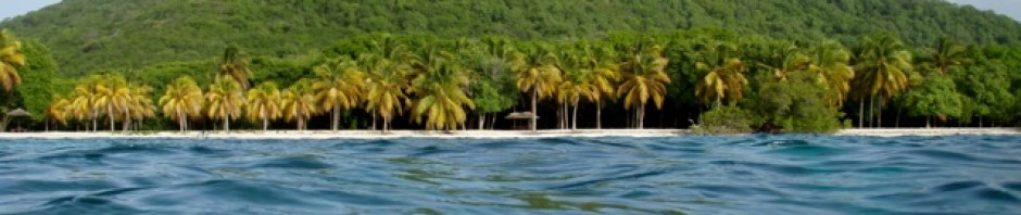
Bimini

Arriving at Bimini we first checked out anchoring on the outside, but soon gave up that idea. It was the weekend and it was quite busy with large power boats racing around, mega yachts swinging on moorings, jet skis and super large fishing boats coming and going. Up the channel we went, towards the basin at the end. Well the channel was a real experience, the gun-boats, (bullet shaped power boats, usually painted a metallic gray or black), with their 4 or 5 450hp engines were not observing any slow down signs, or no wake signs, they were charging up and down the channel.

 The fancy fishing boats too were plough along pushing water, causing large wakes, the channel was a chaos of boats. We just carried on down the channel and found at the end an area to anchor amongst 3 other sailboats. We had what looked like small townhouses with dock space and a marina on one side of us and old tugs in a dredging yard on the other side. Good enough for us to anchor for the night.

After a cup of tea off we went to check in. We knew we had to find Big Game Marina, Alice Town for our check in. We dinghyed along the shore, found what looked like the town docks, pulled the dinghy up a rocky beach and proceeded to walk along the road.

Sure enough we found Big Game and the customs check in. Being as we were both quite tired and dealing with brain fog due to lack of sleep, checking in on their computer was quite challenging. In all fairness it probably is quite easy for the average person and the officials were very patient and helpful. Next was immigration, (we were supposed to visit 1st, but we got it backwards), anyway again the folks there were very helpful and friendly.

Off to find a SIM card, we found the Digicel place shut. So, we asked a sweet old lady in a store. She sold us 2 SIM cards, but didn’t have any data or phone on them. So John went to the gas station, got a few dollars put on the cards and we were set. Back at the boat we set them up and we’re back online.

The night was a very peaceful one. The morning started off slowly, until we spotted a huge barge being dragged by a tug into where we were anchored.

In less than a few minutes I had the anchor up, John had the engine going, and out we went, back down the channel.


Straight out we headed. Neither of us were properly dressed, but out we went heading to our next anchorage at Gun Cay.

Gun Cay

We anchored in the anchorage on the inside of the cay in gorgeous turquoise waters. It was absolutely stunning!


We enjoyed a quiet afternoon and then a lovely swim. John made water, filling the tanks right up. Then while swimming he cleaned a good part of our filthy bottom. (Being in Marathon our bottom was quite dirty with growth); we shared the water with a massive, friendly, barracuda and a huge remora that just ignored us.


In the morning we went exploring Gun Cay first by dinghy along the shoreline and then on foot. There was much evidence of previous hurricane/storm damage.


Parts of the shoreline where there was supposed to be a Honeymoon beach was now baron and rocky with large piles of debris pushed well into the brush-line. The rugged shoreline was obviously very weathered, but somehow attractive.

We walked the spine of the island until the brush grew too thick to comfortably continue then back to the dinghy to head to the lighthouse. Trying to beach the dinghy was impossible as the shore was just rock.


So we dropped the anchor and tied off the shore before making our way towards the lighthouse. I’m not sure of the history of this lighthouse, but it certainly was old and not really maintained.


Climbing up the stairs was dicey, everything appeared to be rusted and rotted out, but up we went for the view.

Back at the boat it was time to head off across the Bahamas Banks.

Crossing the Bahamas Banks

We had decided to take 2 days to cross and spend the night anchored in the middle of the banks. Sailing across is surreal, the waters glassy clear turquoise at just 12 – 15 feet it can feel as if one is just hovering above the sandy bottom. The clouds, sky, and sea, are all shades of turquoise blue for as far as one can see.

We did see a few other boats crossing, the motor boats we could hear miles before we saw then. That night we left the magenta line where most travel and anchored off half a mile in slightly shallower 10ft water.

Out in the middle of nowhere with turquoise waters surrounding us. It was a very calm night, there was a slight slop and a good breeze which made for a restful sleep. As soon as we awoke at dawn we were off, heading the rest of the way across the Bahamas Banks.
Chub Cay in the Berries

was where we had decided to head to for our next anchorage. This cay has a large private marina which is described as being exclusive. Apparently one can go ashore at a fee of $100. As we approached the shores of Chub Cay there were once again quite a few large fishing boats, probably returning from a days charter. Turning into the channel to the marina, off to the side was a recommended anchorage. However there were a few Catamarans sitting right in the middle, plus the channel was somewhat busy with large fishing boats, smaller motor boats and a barge exiting…..we decided this was not the place for us.
Frazer Hog Cay
We turned and headed down the shoreline towards another anchorage at Frazer Hog Bay.

There we found a lovely, quiet scenic anchorage where we anchored up for the night. The night was blissfully quiet with a lovely breeze and still, still waters.


In the morning we decided to head to Nassau.
Nassau

The crossing to Nassau was over dead calm waters that were wonderfully calm reflecting the large white cumulus clouds in the distance…..not at all suitable for sailing it was a motoring day.

The entrance to Nassau for us was the western entrance at Hog Bank, past the lighthouse and towards the hotels and cruise ships. On this day there was just 1 cruise ship in port.


Towards the bridges we headed passing the busy fishing, coastal supply ships and the other commercial docks. On our other side was the huge Atlantis complex sort of an oxymoron of a contrast.


We anchored up in one of the anchorages prepared to tolerate the traffic of tourist boats, go fast boats, fishing and supply boats so that John could go ashore for fuel…..to replace what we had used.

The night was actually very calm and quiet. So with our new fuel supply, which we hoped not to have to use we set off for one of the Exhuma Islands.
Exhumas – Norman’s cay

Our first stop was at Norman cay. We had been there 11 years before. The cay was where the drug cartel had in days gone by been centered, their crashed airplane can still be seen in the waters.

The Norman cay we found has now a marina for mega yachts, big mega yachts.


The pond that had been at the eastern end has been dredged, and has a channel leading in for these huge boats and a smaller channel leading out for the currents and tide.

Believe it or not but there are literally hundreds of mega yachts, we have been so surprised by the number. (a local lady told us they came during covid and never left)


We anchored off the beach on the outside of the marina. The area is very beautiful, but the weather was overcast and so the sea wasn’t its brightest turquoise.


We spent a day exploring the area around Norman cay. The offshore little cays were gorgeous.

We enjoyed walking on many and wading in the shallows. However private signs were posted all over. Again, it had never been like that is the past.

Waderwick wells

The wind was back to its regular pattern of ESE at 15 – 20kts and we decided to head to Waderick Wells where we could await lighter winds as the direction was not favorable. So we had a slow motor day with much of is being in pounding seas. However we did arrive at Waderwick wells where we were assigned mooring ball number 16, a wonderful spot at the end of the field.


Waderwick Wells is part of the Exumas National Park. It is an area of extreme beauty. A jewel! The colors of the water, mixes of turquoise and blues, with white sandy beaches and rugged shoreline make it very popular too.


We spent 3 nights there totally enjoying our days. Our sail track had been having issues and John was concerned about future possible problems.

So we took advantage of being in a relatively sheltered mooring field and took it down and replaced it with the new one we had purchased in the US. It proved to be an easier job than we thought.


On our 1st afternoon we set off to do the hike to Boo Boo Hill.

We took the track called the “Causeway” that runs across the rocks at the edge of the mangroves and ends a the causeway bridge.


Sounds quite simple but it’s actually quite tricky and requires attention to to your footwork. The scenery was wonderful, the Mocking birds were singing, and it was a lovely day.


Once at the bridge, we traversed the rocks to the other side and climbed the rocky trail to the top.


The view was stunning. We could see far and wide across the island.

Going downhill one really needed to be mindful of where you stepped. There were many, many sink holes and rocks to climb around, across or over.

And then we were again up a steep slope and onto the Hutia Highway, turning to the left for Boo Boo Hill in the distance. The view once we reached the top was absolutely, wonderful, just stunning!

The outside of the island the seas were up due to the winds and they were pounding ashore.


We admired the view and headed off along the cliff tops towards Boo Boo Hill.

Before Boo Boo Hill is a monument that faces out to sea dedicated to a couple that were well known locally.


There is also a large bench which is a comfortable place to sit and look out to sea. The view amazing!

At Boo Boo Hill you find a mass of memorials in the form of boat signs, homemade tokens, reformed objects all a remembrance of those that passed through….ours is there somewhere in the pile from 10 years ago.


The view was stunning looking out over the whole cay. Down the hillside we trekked looking over the cliffs at the blowholes and then down the other side towards the mangrove flats.

This way takes one through the shallow waters of Banshee Creek

and back to the beach where the dinghy awaited us.

Our next adventure the following day took us

along the same trail initially and then we took the right branch towards the other end of the cay.

It was another hot, dry, day with wonderful blue skies with puffy white clouds.

Again the views from the cliff tops were spectacular.


The beaches wild, the pathways were marked with cairns and a paint mark but were not well trodden. We made it as far as the old wall and then headed back.

This time taking what was called the Shady Tree Trail


through the trees and palms in the lowland. Finally back along the Causeway to our dinghy at the beach.

Waderwick Wells is a gem, a wonderful area to visit.
Staniel Cay
Was our next stopping point. We were only able to move in small jumps as the winds were blowing in the constant direction of where we wanted to go, as usual. As per usual it was a motor sail to Staniel cay.
At Staniel cay we opted for a nearby anchorage, at Big Majors Spot which is where the swimming pigs are to be found.

Once again there were dozens of mega yachts, go fast boats and large powerboats anchored and moving about. Such a change from 10 years ago.

We headed into Staniel cay to get a few supplies and have a walk about. Once there we tied off the dinghy area and enjoyed a walk about.


When away from the marina area one finds a quiet narrow, windy lane, with very few vehicles.


We wandered along the narrow lanes visited a shop, The Pink Grocery store, bought a few bits and the walked back to the marina where the tourists were petting huge nurse sharks.

Next day we started off by doing a repair to the mainsail. A baton fitting had been shaken loose from when we had the old sail track. We were again pleased with our repair and headed ashore to the Yacht Club for lunch.


Lunch was excellent, fish with Asian slaw, plus not expensive. We wandered for a walk about and picked up a few other supplies from the little grocery before we headed back.

Back at the boat we got into our bathing suits and headed first into the pig beach to see the swimming pigs. There was just one other boat feeding the pigs, we stayed back, watched and took photos. These pigs are adorable, obviously well fed and cared for as they are the “stars” of the area.

The locals have someone watching over them due to problems in the past. From there we dinghied about checking out the lovely beaches, turquoise waters, rugged shoreline and rushing water through the cuts.

We ended with a refreshing swim at one of the little bays. (Neither of us wanted to swim off the boat as there was a huge shark hanging about. It was a nurse shark but still…..)

Black Point
was our next destination. As said, little hops was all we could do, until we had favorable winds, but time we have. Black Point is another small settlement, although it is referred to as the second largest.

The bay is very large and shallows out to the beach. Ashore we found the settlement delightful. There was a lane along the shore that we followed to and past the beach

and then we followed a trail over the headland to look out over the sound – Beautiful waters as usual.

We strolled the same lane through the settlement, past the school, the church, the police station


and to a restaurant, Emerald Sunset View where we had another great fish lunch with gulls looking on.


The locals have a basket weaving center and store, unfortunately it was closed. But we could see many local women and men weaving outside their homes.

I spoke to one lady, who told me she learned from her parents and was using a marsh palm. She was incredibly quick with her hands, as fast and nimble as knitting needles.

Little Farmer’s cay
Still awaiting favorable winds we headed off to an anchorage near Little Farmer’s cay. Arriving by noon meant we had time in the afternoon to explore the area.

The cruising guide/navionics mentioned a cave to explore. We set out in the dinghy to check it out and the cut that passes out to the Exhuma Sound. We need to head through a cut in order to be on the outside of the Exumas to enter Georgetown.

The cut looked very straight forward, basically following the channel made by the current around and about and then out. The seas through the cut were just crystal clear, incredibly beautiful, with a very strong current running.

Off we went to find the trail to the cave.

Anchoring off one of the beaches we waded ashore and basically followed the beach and the old foot prints to where there was a cairn marking a pathway inland.

The trail was the usual mix of rocks to climb, sandy path, and then a mangrove swampy area.


John as normal disappeared ahead while I stopped every so often to take pictures. I arrived at a lovely horseshoe shaped beach on the other of the island…..but no John?

So I figured he had ended up at the cave…. After wandering the beach a bit I could see him way up a hillside in the shrubbery. I whistled to him, We waved and he found his way to the beach. Sure enough he had found the cave.


We roamed the beach and rocks for a bit and then headed to the cave. The cave was interesting, the regular limestone cave, of which there must be dozens hidden away.

Back to the beach and dinghy we slogged, it was so incredibly hot, no breeze, everything dry and toasty hot, like traipsing across a semi dessert.

I could definitely do with a swim to cool off.
We needed to access the Exhuma Sound in order to enter Georgetown. In order to do this one must power the boat through a cut to the sound. This can be quite intimidating as the tide, ocean flow/current’s huge volume of sea water through the cuts is pretty awesome.

We headed off to Farmer’s Cut early in the morning anticipating a slack tide. However upon arriving we could see the tide was already flowing inwards.

Wow, what an exit, Aeeshah powered against the massive current for over half and hour. We took a wave over the bow, it washed right down the whole boat and unfortunately a hatch wasn’t properly secured so we had water below too. Out of the current we navigated towards Georgetown on Great Exhuma.

