PHOTOS—>>. https://photos.app.goo.gl/BTAY6aLxa7JEPXhp7
Heading to Loretta pt1
After getting back from San Diego we jumped right back into boat chores. John had the dinghy up on the bow and tackled the leaks using the glue he purchased while we were away.

I got onto a deep clean from bow to stern. We both went on major restocking grocery trips, anticipating several weeks away from any supplies. Meanwhile the port was closed due to high winds. Once the port opened we were more or less ready, so after saying good bye to fellow dockside friends we headed out.


The shallow channel leading out was still quite choppy, but we made good time as the tide was ebbing and this made travel quicker. Our destination was:
Ensenada De La Raz, Espiritu Santo

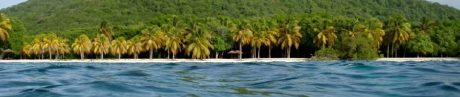
This bay is the northern most of three finger coves and offered better shelter. When we arrived we found the second bay had a few boats anchored but La Raz was unoccupied which was wonderful. We anchored in the shelter of some dramatic palisade cliffs with the bay’s shallow water stretching inward quite a ways.


The next morning we headed ashore towards the long rocky spit. Having learned what happens in these parts with the dropping tide we anchored the dinghy off of the shoreline in a couple of feet of water and then waited ashore.


The rocky shoreline turned out to be a long peninsular which enclosed a salt pond. I really enjoyed walking along its length looking at what had been washed ashore.


There was all kinds of fish, many many shells, drift wood of all types.


Next we headed inland towards look for the supposed pathway which was to lead us to the other side of Espiritu Santo.


It was fine to begin with but, as we waked along the shoreline and at the mangroves we walked along the wetland, but then the pathway faded into the brush.


After just a short stretch of trying to walk this pathway my lower legs were all torn up from thorns.


Every single type of shrub, bush, and grass type vegetation has thorns! Thorns of all sizes and types and the only way we had to remove them was with our hands. We now carry pliers with us! See John’s burrs or thorns, and they didn’t come out easily.


Back we went, giving up finding the supposed pathway there. John saying it must be on the other side of the bay.


On the bright side the scenery was wonderful! And the exercise was needed.
Back at the dinghy we found that, yes, the tide had dropped, but we could just get over the shallows using the engine, so our timing was right.

The following day, John was all set on finding the trail to the other side by scouting the other side of the bay. However the other side was much shallower, and had mangroves at the end.

So we had to leave the dinghy quite a ways down the shoreline anchored off of some rocks, walk the shallows and then the rocky shoreline.

What we found at the end was basically a dead end. However again it was a fun walk. On the way back John discovered an area,

where there must have been shelters built at one time as there were foundations there. Plus there were piles and piles of oyster shells,so maybe it was a fishing camp.
Leaving Espiritu Santo for:
Isla San Francisco.

“This is a pristine island known for its crescent-shaped bay, white sand beaches, and turquoise waters. Located roughly 75 km north of La Paz, it is a popular, remote destination for anchoring boats, kayaking, and hiking to panoramic viewpoints.”

The island is roughly 2.5 km by 2.5 km, with a distinctive, hooked, white-sand bay called Bahía Amortajada, or as most cruisers know it “the Hook” due to its hook like shape. It is in this bay we intended to anchor for a few days.

We were both excited to head to new territory and after reading about San Francisco we had high expectations.
Upon arrival we did anchor in the shelter of the hook, but came to regret our choice as this was also where all the charter cats anchored later in the day. So after a day surrounded by them we moved to the other end of the bay where mostly monohulls were anchored.

Exploring the agate beach

According to our information, on the other side of the island from us was a bay famous for agate.
What is agate?

Agate is a colorful, quite sort after, rock that typically develops within the cavities of volcanic and metamorphic rocks. These areas with layers of silica-rich fluids gradually formed leaving deposits and creating the stone’s distinct colour, banding and patterns.
Agate is also believed to have healing powers, and to enhance mental clarity, improve concentration, and more. So off we went basically agate hunting.


Up over the sand dunes, the views were captivating. Along pathways lined with thorny brush and cactus and then crossing the salt pond we went.

On the salt flats, there were pits dug for the salt to form and harvest, but due to the rain that had fallen just a few days before the pits were diluted.

Across the salt plain we trekked arriving at the agate beach. There were millions of rocks,no way of telling what was agate.

Down the beach we went me beach combing, John rock hunting.

The cliffs at the other end were very attractive with such unique formations and colours.


We did pick up several rocks, choosing the greens this time. But they weren’t agate according to John’s rock identifier.


I found many interesting odds and ends while beach combing. Several porcupine fish skeletons, loads of oyster shells, fossils and more.


The cliffs and rocks were of amazing colors. Green, reds, yellows all types of rocks, it was a rough rocky beach walk.


Back to Aeeshah we headed after another very nice trek
Climbing the ridge

Above us was a ridge line where I spied several folks climbing, so that climb became our goal. The next morning off we set to hike the ridge.

Getting there we found a pathway halfway down the beach that cut over the dunes to the salt pond area. Next we crossed the shrub land on a trail that lead to a rocky pathway heading towards the ridge.

Up we went coming to the ridge line.

All the time the scenery was lovely, but from the ridge line the views proved to be amazing. We walked the narrow ridge, with rocky slopes on both sides of us me stopping to take photos.

At times the pathway was really quite treacherous, one slip and down you would go off the cliff on one side or down the steep slopes on the other.


Upon reaching the top we were both stunned by the view! It was stunning! And with the clear sky the colours were incredibly rich.


After spending a while on the top we headed down. The downward I found was much harder, mainly because of my recent knee surgery. Anyway I hung onto the back of the back pack on John’s back in case I slipped.


Halfway down we chose a different route by following the ridge along further to another lower view point.

We saw an osprey pair nesting on a ledge above the ocean. Way off in the distance we saw orcas swimming.

The hike was wonderful!
And then we were off again…..

“After climbing a great hill, one only finds that there are many more hills to climb ” – Nelson Mandela
“Realize deeply that the present moment is all you ever have” Eckhart Tolle
