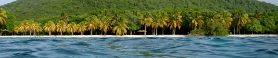
AMAZING SABA
PHOTO LINK—–>>Amazing Saba
 We finished up most of our planned jobs and as the weather
 was forecast to be quite mild, (which is unusual for the time of year); we decided to try to visit Saba. We headed out of the lagoon, cleaned all the growth from 3 weeks in the lagoon, said goodbye to friends and set out to visit the mysterious Saba.
 Saba
Saba
 has a reputation for being quite inaccessible, due to the
  fact that it is 5 square miles but 3000 feet high. The seas crash against its rocky shores that surround the island making accessibility dangerous and difficult when trying from any vessel.
There is only 1 small “port” – Fort Bay, which is really just a short sea wall partially sheltering a dock. This has only been recently built and Sabians had used a rocky beach  to land where they had built a rocky
stairway called The Ladder. There are few anchorages, all of which are exposed to the seas, and so it is often too rough with the high sea swells to even consider stopping. The bonus was that there were moorings available.
Before we had left I sent an email to friends Jo and John off Out of Africa to find out if they  were on their way to the Virgin Islands as they had mentioned in their last email. John and I were happy to hear that they would meet us in the US
  Virgins.
We sailed to Saba on the 23rd and had a lovely sail across. Upon arriving we could see only 1 boat in the anchorage and as we got closer we could see it was Out of Africa. As it turned out
 they had sailed over night to Saba to surprise us. It was an excellent surprise as now we had company for the hikes. The anchorage is on the west coast and so we all dingied the 2 or so miles in our dingy to the southern “port” to check in.
Once we were checked in we set off to explore the village called The Bottom.
 Now, The Bottom is at the top of a very steep winding roadway, which is above the landing area, but it is below the rest of the island, which is higher up, thus it is the bottom even though it is nearly at the top. The walk up to The Bottom is not an easy one;
 most people get a taxi or a lift. We were sure we could easily do it, but once we were 3/4 of the way up we very gratefully accepted a lift the rest of the way.
 The Bottom is quaint, the lanes are narrow and some are cobbled, the houses white with red roofs most with pretty gardens in front, the street signs are hand painted, there is order everywhere, no trash. It is charming.
We strolled around and then headed down the steep roadway to the landing and our dingy. That evening we had a fun evening catching up aboard Aeeshah.
Day 2 in Saba was the day for hiking Mount Scenery.
Mount Scenery

is the highest point on the island at 2877 feet above sea level. We had all decided to catch a taxi to the start of the trail in The Windwardside the second village in Saba. (And yes it is on the windward side). We were driven up to The Bottom, along the narrow –
 The Road They Couldn’t Build, (that is the actual name
  given the road). The story goes that nobody was able to build a road as all the engineers said that it was not possible due to the formation of the island. So one of the local guys called Lambee did a course and he worked out that a road could be built which has now been done. It took over fifty years
  to build and was quite an amazing feat. Anyway we drove along this amazing roadway where we could see the steep drop offs at the roadside and up into the village called Windwardside.
We headed up the Scenery trail.


The trail is just lovely! It has 1129 steps and lengths of pathway that all wind  through the rain forested and cloud forested slopes. It was a
 well-trodden trail, but with the steep incline and all the steps of varying heights it was tough.
The few viewpoints were awesome, the many flowers, butterflies and different birds made the climb just lovely. At the top there is a communications tower and behind it is the easier of the view points where you scramble up a rocky slope to gaze down on the villages, houses and  sea below. Except for us it was quite clouded so we gazed occasionally through the clouds at the scene below. The
  second viewpoint would have been an amazing view of the drop off except again all we saw were clouds with a glimpse of the slopes below.
When we reached the bottom of the trail we headed off to explore Windwardside. We found that it is a beautiful village with cottages with white walls and red roofs, lovely garden all are immaculately kept. Off we set from there to walk back to The Bottom along The Road They Couldn’t Build. It was quite a long down, up,

 down, downhill walk, but the views were amazing. It was an unforgettable day for us all.


Day 3 in Saba was decided to be the day we tackled the

 Ladder.
In the olden days there was a ladder, (now a national monument), and consists of actual steps. It was from fairly near to where we were on a buoy. The Ladder has always led up to the

“The Bottom”. It used to be the only way onto the island and any cargo had to be carried up the many, many steps. The people who lived there in that era must have been extremely fit.
We landed Out of Africa’s dingy and scrambled over the rocky shoreline and headed up the staircase. I must say the people on Saba have built  thousands of steps, they are step builder experts, but no 2 are alike. Up, up, up we climbed
  stopping to appreciate the views along the way, plus catching our breath and resting my sore leg muscles. The views are spectacular, a rugged but beautiful shoreline.

Once at the top we set off uphill to The Bottom where we  again headed up an extremely steep hill to the beginning of the
Sandy Cruz Trail.
 This trail once again took us through the amazing rain and
 cloud forest; the plant life is lush and green of every tone. The pathway is very well maintained and follows the mountainside around and up and down.


 Again the views were just spectacular looking down into our anchorage and across the slopes.


 We stopped for a snack lunch and had then decided to follow the
All Too Far Trail,
 which took us towards the Sulphur mine and near the
  airport on the other end of the island. This pathway had obviously not been trodden for some time and was quite over grown in parts, plus as we approached one deep gorge it became a loose rocky track that was steeply inclined downhill, luckily there were ropes to cling to. Poor John disturbed a group of hornets, which then attacked him, he was stung twice.
 We decided not to visit the sulphur mine as it would mean
  even more downhill and then back up again and we still had quite a climb ahead of us. We could see a plane below us coming in to land at the tiny airport.
 The airport
is really an airstrip and is really tiny. Again the islanders  were told that it was impossible to build an airport, but they found the only flat area, cleared the stones and built the strip. This strip is above high cliffs and so the planes take off over the side of the cliff. The pilots have to be specially trained to land on this
  airstrip. We watched the plane land and take off and then trudged uphill.
Jo spoke to a group of locals who were shocked with how far we had hiked. One of the men, Bussy Bussy volunteered to drop us at The Bottom as he was heading that way. We very gratefully climbed aboard his truck and headed back to The
  Ladder and the boats. It had been another excellent day in Saba.

Day 4 was another hiking day,

 but less intense. Everyone was suffering with stiff muscles. We dingied around to the “port” and got a taxi up to The Westwardside. There we followed
Maskehorne Hill trail.
It led uphill to a fabulous look out over the Westwardside and the sea below. We spent time looking out to sea and then headed along the

Bottom Mountain Trail.
It again was a lovely trail, which led through some farmland, by little, stonewalls and forested areas. We  stopped for an early lunch by one of the little stonewalls in the shade and had a picnic lunch. It was just lovely! It was then back down to The Bottom where we had an ice cream and dingied back to the boats.


 Day 5 we went snorkeling around the pinnacles
and the bay that we were moored in. The rugged harsh shoreline was spectacular from the dingy looking up at the soaring sea birds and the jagged rocks above. The snorkeling was quite good. I saw several turtles and there were 
 many fish of all types.
In the afternoon we set sail for St Croix arriving at 07:00ish. It was a very rough downwind sail, but I was pleased not to have been ill.

Christiansted, St Croix
PHOTO LINK——>>St Croix
 In St Croix we anchored in Gallows Bay off of the town of
  Christiansted.
It was a nice anchorage with a small park and beach area. As we had sailed over with Out Of Africa we went in together to check in. That proved to be a long process mainly due to our Bermuda passports. The official had never seen one and could not  understand why we were exempt from the visa waiver form.
  Anyway she now knows Bermudians have a deal with the USA.
Also anchored in our bay was Bad Bunny with John and Kay, another boat we knew from a while back. Then after a day or so Anna Lee arrived with Patty and Bill, (Bull as Jo pronounces his name). 
 We had several fun evenings aboard each other’s boats. Even Chico went to Out of
  Africa and Kay and John brought one of their cats, Swat, so the cats could get to meet. They were not unfriendly but nor were they friendly, they just watched each other.

Then on the last night in that bay, John (O of A), arranged a “fire” on the beach. Actually a barbeque in the camp ground, it
  was great FUN! We dingied ashore around 4:00pm, set up and had an excellent barbeque/pot luck using his Webber.
 During the few days we spent in Christiansted we visited
  the Kmart and local stores several times to stock up. We wandered around the Gallows Bay area and explored.
One day we caught the local circuit taxi and travelled to the
 Cruzan Rum Distillery.
The group went – 6 of us, we paid to get in and were given 1 entry ticket plus 2 drinks tickets to try the rum. Well unknown to us John (O of A), had lifted a handful of drinks tickets when nobody was looking. We did the tour, which 
 was interesting and educational, then were treated to our free samples. Kay, Jo and I chose to try the Pina Colatas while the guys; John, John (O of A), and John, (Bad B) did the punches. Before you knew it they had more punches and our seconds, this continued on until the numbers didn’t match and we figured out what John, (O of A), had done. It was quite a laugh. The walk back to the main road in the rain for the
circuit taxi sobered the guys up. It was a fun day out.
 Another day was spent walking around Christiansted, which has been a port since the 1700s. There is a lovely fort,
Fort Christiansted,
which we wandered around reading the history of the place. The streets have many older buildings with wonderful  architecture that has been influenced by the 7 nations that
  have all laid claim to St Croix. They were: Danes in 1735 and actually influenced much of the architecture. Then there have been: Spain, Holland, England, the Knights of Malta, France and now the USA, all laid claim to St Croix. I enjoyed wandering the streets looking at the wonderful old buildings, especially the old churches.


We had applied for a permit to visit Buck Island where we spent a few nights.
 Buck Island
Buck Island is a National Monument, Park and reserve. There were several boats moored at Buck all of which John, (O of A), also invited to join us on the beach in the area provided for evening fires/barbeques. It was great fun meeting new people


 and catching up with those we knew.
 We also hiked the trail on Buck Island, which was lovely.
  There was a great look out at the top. The vegetation was a mix of cacti, succulents, and air plants along with huge trees. And I even managed to see the native orchid too. There was an abundance of birdlife and the sea was crystal clear, turquoise blue with seabirds soaring above. We also snorkeled
  the lagoon and circumnavigate the island in the dinghies. Everyone had a fun few days on Buck
  Island.

Frederiksted
 From there we sailed to Frederiksted, the other town in St
 Croix. I had heard from a friend that it was her birthday and that we were invited to her beach party on Rainbow beach.
We anchored off of Rainbow  beach, which is just a gorgeous, long sandy beach with crystal clear water. Again there have
  been several other boats all of which we are acquainted with: Karma, with Joan and Graham, Amarula with Eric and Lynne, whose BDay it was, Jo and John from Out of Africa, Kaye and John from Bad Bunny and a family on Avatar.


Lynne’s birthday party on the beach was great success. It started in the afternoon and ended in the evening. We swam, ate and made merry. There were many residents 
 from St Croix there too. We then had to have a second evening on the beach, as there were so many leftovers.

As a group we have hiked to
 The Washington Estate
where we saw the ruins of the plantation buildings and a recently added Labyrinth.


We have hiked along the Mahogany Road to the Domino Pigs.

These are pigs that drink  beer. Yes, they actually open the beers and drink them, then crush
  the cans when they have finished. The beer is now non-alcoholic, as 1 had died from liver failure due to over indulgence.

Another hike was to Sandy Point.
This is just as its name sounds, a sandy point at the end of a looooonnnnng sandy beach. It was quite a hot trek to the end and then back, but the scenery was lovely.

 That evening we had a goodbye dinner on Karma as they and Bad Bunny were leaving for different destinations. We had hoped to stay in Frederiksted until leaving for St. John, but the weather did a change for the worse, the bay became too rough for it to be a safe and comfortable anchorage so back to Christiansted we went.

 In Christiansted we travelled as a group on a route taxi to
  The Whim Museum for a visit, walked to Kmart, and walked on to St. George Village Botanical Gardens.
The Whim Museum
is a restored sugar plantation and  rum estate. It was founded in 1733 under Danish ownership. It is restored today and
 displays
much of the history of the estate and the persons who were enslaved or who worked there. It was interesting to wander around seeing and reading about the history of those times.
The St. George Village Botanical Gardens.
 Comprises of another sugar plantation ruins with historical
  structures along with the botanical displays. Again the ruins were interesting as was the history. I especially enjoyed the orchid display.


 We caught a circuit taxi to the Agricultural Show,
which is an annual event in St Croix. It has representatives from all the Caribbean Islands and displays from them too. I found it to be quite similar to the Agricultural show in Bermuda except with much more emphasis  on food. There were rows of food stalls and all with very similar island foods and juices. We all walked around looking at the crafts, vegetables,
 fruits, plants, farm animals, school displays and such. After 2 hours I think everyone had had enough of the crowds and we were happy to leave.
That evening there was a – Jump Up –

 in Christiansted, which we attended. So what is a Jump Up? Well the shops, and restaurants were all open, venders were along all the streets, musicians were set up along the streets all playing different styles of music and local food and drink stalls were serving food and drink. Plus there were fire
 dancers and the local dancers the Mocko Jumbies were dancing on their stilts. We enjoyed the evening again along with the other cruiser friends that were there.
 Chico was invited to spend some time aboard Out of Africa with Jo, as she just loves cats. He went over in the dingy in his usual carefree pose at the bow. He apparently re-explored their boat poking his nose into everything, having a wonderful time. John picked him up and proceeded to return with Chico again sat on the bow, but he must have felt John wasn’t going fast enough cause he wiggled his backside and leapt/dove off the bow and proceeded to swim
 full speed for Aeeshah. In fact he swam so fast John had a hard time keeping up with him, he was leaving a wake behind him. Jo and John said they could not believe it when Chico jumped off the dingy and chose to swim back to the boat. We said well he’s a very unusual cat, but a true boat cat.
We were waiting a good weather window to sail the 35 odd miles to St John, but the wind was too light. So we all decided to return to Buck Island.
 Back at Buck Island
we enjoyed rehiking the trail but the other way around and explored some of the shoreline too. One evening we had dinner aboard Out of Africa with Jo and John, which was fun. Then on the last night we had a barbeque on the beach. Kama with Joan and Graham had arrived plus another cruising boat – Dove with Diane  and Steve aboard joined us for the cook out. Once again it
  was an excellent evening with 1st class company.
“Each friend represents a world in us, a world possibly not born until they arrive, and it is only by this meeting that a new world is born.” – Anaïs Nin
“It’s rather nice to think of oneself as a sailor bending over the map of one’s mind and deciding where to go and how to go. The great thing to remember is we can do whatever we wish to do provided our wish is strong enough.” – Katherine Mansfield
