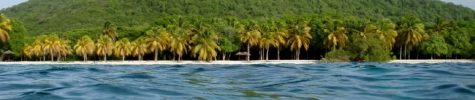
St Maarten again <- PHOTO Link
We spent over three weeks in St Martin, on the Dutch side.
 During this time we were able to nearly complete our chore list. Many friends ask, “what do you find to do on a boat all the time every day?”
It is incredible the amount of maintenance necessary to keep Aeeshah up and running. John’s time was spent installing a new sail track for the main sail.  Maintenance on both heads (toilets) that also included – for one of them new piping, (the old was clogged up with hard gunk – most disgusting). Installing new lighting, maintaining old,
  getting more mast steps up the mast – he’s nearly at the top. Work on our failing battery bank with the ever-present question – should we renew them???? And me, what did I do…..made new sunshades for the forward and aft of the cockpit, (with all our soon to be guests in mind), plus made a new cover for the foresail and covers to
  replace the ones John has “lost”. Work on the website, learnt to download movies for free using torrentz, and then download them, photos sorted, tidied lockers and cleaned up all round. Yep we were busy, busy busy.
 We also took excursions ashore. Several more visits to the airport were necessary and fun. One of the times we went with a group of friends which
  was interesting as everyone was off either taking photos of planes landing or of people getting blasted by the jet burst or they were in the jet blast or swimming and watching it all.
Another day we took the bikes ashore
 and rode a circuit all around the peninsular. Past Maho Bay beach area, of course visiting the airport beach, along
  through the Grand Etang area and into French St Martin. Where I found there were hills of 15%, I pushed on and John rode but stopped every 20 feet or so.
In the French area the traffic was nuts, driving like loonies with a 90 k an hour speed limit at one stage. We rode round the town of Marigot, visiting a  market and back to the Dutch area where they are saner drivers, over the new bridge and back to Barnacles where we started. It was lovely riding the bikes.
Another evening there was a huge firework display from the new Dutch bridge. This was to celebrate its opening. Absolutely amazing firework display, they really know how  to do fireworks. We had seen them setting up on the bridge and even that was impressive. Huge flat beds were driven and parked at intervals along the front was driven off leaving the beds laden with the explosives. The display as said was spectacular and long, music played and after
  there was a huge party, which we did not attend. Next morning at first light not a flatbed remained, they had been driven off during the night.
We took a walk towards what we thought was a nature 
 reserve, but which turned out to be a children’s riding and petting zoo facility. To get there we had to walk through the electric power plant. John found it very similar to BELCO, same smell, same sound and such. The area was not what we expected but we walked the horse trails and enjoyed the exercise.

 We were invited to go on a walk that was labeled
“the hike from hell”.
Mark from “Sea Life” had previously been on this hike and he was the organizer. We were told we had to have at least 2 liters of water plus to wear long plants due to the nettles, which stung like a thousand knives. There turned out to be 14 of us that met at Lagoonies at 9:00am. John and I were the oldest, the youngest was  Marina at 19 and the rest ranged between, most being under 40. Interestingly enough one of our group had summated Everest, while 5 had reached base camp, 9 of us, including John and I had hiked at over 10,000 feet. The
  fellow Maxter, who had summated Everest and his wife Molly were definitely the most experienced of the group, also very interesting to chat with along the way.
The walk did start off hellish for me as it went straight up a steep roadway, which was very hot, lacking any breeze or shade. I really felt it and thought maybe I’d better drop out, but Marina kept me  company and encouraged me. At the top of this road everyone gathered and I found that while I was last up, many of the others also had found it tough.
From the road we then scrambled into the thorny bushes. The path itself was very narrow, overgrown, rocky and full of prickerly shrubs, bushes and trees with thorns and cactus all round. The path wound its way up and up and up, but as it was not as steep as the road previously, it wasn’t as tough. Rock climbing was a big part of the challenge and having a good 
 head for heights helped. As it went on we did have sprinkles of rain, which cooled us off but also made the pathways that led down very slick and slippery. I was very pleased to have my walking stick as it really helped me not to fall. In places you had to squat and slide down hanging on to the trees that didn’t have thorns. The overlooks were lovely
and everyone enjoyed reaching the top of the 4 rocky peaks that looked right over the island. It was an excellent day’s hike.

That evening we went to “Little Jerusalem” and had a Shormah for dinner. They are fantastic! The fellow that owns the place is from Palestine and he cooks the food from scratch. Mine was a mix of shaved lamb, onion, lots of garlic, seasoning and a yogurt sauce plus salad inside pita bread, and all for $8.
 One Wednesday evening we joined a large group of cruisers for drinks at Barnacles followed by a Chinese dinner.
It was a fun evening which John and Jo from Out of Africa organized. There were over 40 of us and the way it worked different platters were brought out with different Chinese dishes. Take what you want and pass it on. It was really good food and just tons of it. Our bill was $10 each,  just amazing!
Off to Anguilla
Anguila <—–PHOTO LINK
 we went on February 4th. It is very close, just around 10 miles or so. After spending 6 days there our consensus is that Anguilla is clean, very friendly, safe and quiet, but expensive.
The bay to check in, Road Bay,
is lined with wonderful white beaches. The dingy dock leads right to customs and 
 the officers there couldn’t be nicer if they tried. The water is crystal clear, beautiful turquoise, green and blue. There are turtles swimming all around the boat and there are no jet skis or such. The reason for all this is that most of the waters and bays are marine parks with lots of rules. The cruising fee to go to the
 other bays is so steep that not many bother – us included. At $71US just for a day per anchorage it is not gonna happen. Water toys are banned, as are nudists – not like their neighboring islands Anguilla is
  British and so very conservative. This does make it more relaxing.
Our first adventure was a bike ride to the Capitol – The Valley.
 Now others had told us that Anguilla is flat, well they can’t have been here. It is not mountainous but it is very hilly. I
  should have guessed this by the name of the Capitol – The Valley and by the fact that on the map all the villages have Hill in their names. Road Bay is on the beach, but the island is surrounded by cliffs that at their bottom have the beautiful bays and beaches.
 So off we went the 1st hill was just down the road and in fact it continued all the way to the outskirts of The Valley then it was down into The Valley knowing the only way out was uphill. Our mission in The Valley was to find Digicel
  and get data for the iPhone. This we accomplished after a good hour in there getting it set up.
We then thought we would check out a few of the bays. Uphill we went to each bay only to decide that the hill down to each one was too steep to be bothered. So we followed narrow lanes through neighborhoods and up hills into villages. The countryside  is basically scrubland so rather plain, but the views down to the bays are lovely. We spent a good 4 hours biking around our immediate area and then headed back. Lunch was had in Johno’s bar and grill, which was
  great but too expensive for our budget. While at Johno’s we met up with Nadeem off of “Africa” we had first met in Grenada and then again in St Martin. It was his birthday and we were invited aboard for an evening beer. John went but I was just too fatigued from the day.
The next day off we set again, this time towards the western end of the island – Cove Bay.
 We rode all along the cliff road/tracks over bumpy trails, which looked down on beautiful turquoise bays below. The first beach we visited was
  Mead Bay. It must be good mile long, pure white sand and perfectly clean beach and water, just pristine. We continued past some very new fancy developments, which are aimed at the top market tourists. Whether they do well or even all sell or get finished is to us debatable. Everywhere we have traveled we have seen the same thing, foreign developers building big and often the places left empty and unfinished. We found Cove Bay and it must be one of the most spectacular beaches. As far as
  the eye could see was white beach with waves crashing from the surf rolling in. Behind Cove Bay was an amazing development that was open and running. It was situated in the adjoining bay that was sheltered. Built
  in the Middle Eastern design there were individual units behind the bay, the place looked quite fabulous. It boasted a wellness center so it must be for the stressed out folks to visit, later we learnt it is ranked Best in the World 2013.
Our ride back was tough as it was against the wind and predominantly 
 uphill until the very end when we could coast downhill to Sandy Road and Road Bay where the boat awaited our return. Another swim off the beach finished a good day off for us. During this swim I was adopted by a group of little girls who before I knew it where having me teach them to swim and float.
We rented a car
one of our days there and drove around the Eastern End of Anguilla. We started by visiting world 
 famous Shoal Bay.
It had been rated as the world’s best beach some years ago but has since suffered some sand loss. However it is still a wonderful beach, but set up for the tourist trade and so not really ideal to my way of thinking. Our next stop was Sicily Bay, which was very pretty with local fishing boats moored.
On to the Windward Point

 we ventured, now this took a bit of looking as the roads ran out and we just had tracks through the shrub to follow. We first found
Savannah Bay, which was wild and wonderful with kite surfers taking advantage of the windy conditions, and we had Junk Hole Bay, which was rocky and covered in sea junk that had washed ashore.
After using the iPhones Google earth we managed to find the track out to the end of the 
 peninsular. The interior is covered in cactus and shrub that is quite low lying and all looks the same so while it is attractive in its own way it does all look the same and is easy to get “lost” amongst the windy tracks. Way out on the Eastern peninsular there was a wonderful wild shoreline, Windward Point,
some was beach but most of it was rocky and rugged with jaggered rocks, huge boulders, and cactus clinging on. We had stopped at a Chinese 
 grocery and picked up cheese, ham, bread, fruit and drinks, which we then loaded into the backpack and set off to explore and have a picnic lunch. We spent a few hours exploring, hiking around and having a picnic lunch in the bit of shade cast from a group of boulders.
Not one other person did we see just some boats sailing by. The rest of the afternoon was spent driving around the shoreline and exploring the various tracks. John enjoyed the driving over the rocky, bumpy, sandy track, however it did get a bit tedious after a while of bumping and 
 banging about in the car.
After a swim we went ashore for a drink and meal, it was then we found out how expensive drinks were in Anguilla. 6US$ each was a real shock after paying 1US$ for a beer just 10 miles away in St Martin, so it was time to leave. We really enjoyed Anguilla but felt we had seen much of the island. We were not willing to buy the expensive cruising permit that allowed us to day visit their other islands nor did we like the  over priced bar drinks. The people were wonderful, everywhere we went on the bikes we were asked if we needed help or of they could help us or show us the way.
Back to St Martin
 we sailed and it was a wonderful sail gliding along on a reach. John
  enjoyed gliding past a 54 foot Oyster while we were reefed. The Oyster then put out full sails and slid past us. Back in St Martin we were booked in to Custom Fit Marine to have some work done to our poor old windows, which we had in the past had, leaks. The first window is in and what an improvement, it looks excellent!
We were off on another hike
with a group of friends, who invited anyone  who was interested to come along as it was a walk anyone could manage. – This proved to be inaccurate, as we later found. Well a group
  of 38 met at the dingy dock, walked to the buses and piled aboard. The ride there was straight up a very narrow road with a drop down on one side, to the highest point one can reach by road. The bus we were on was a longer one and he was only able to turn around with the gods on his side.
 Off we piled, up we walked to the 1st view point, much to the anguish of some who had expected – no uphills. The
 view point was lovely but not on our trail so, down we went to where we had been dropped off to follow what was thought to be the correct trail.
Down down down went the rocky slippery trail until we found all 38 of us in the zip-line – pay to enter – establishment. Well we were way off where we should be so it was either continue to go down going through the facility  OR hike back up and find the trail.
John and I were with the other 12 who went back up.
By this time it was well into the day and so not so cool any more, but we found the shade and the breeze did keep it some what comfortable when we hiked all the way up again. As we went up we never did find the path and it was only once at the top we discovered the correct path over the ridge line. Off we set, it turned into a challenging but fun hike. Most of the group were the same friends we had hiked with before. The view points were splendid! And we finished at 3:30 – having started at 9:30, yep 6 hours!!
“The greatest boundaries that we face in our lives are very often the ones we ourselves create in our minds.” Ellyn Spragins